Area Overview for L10 2LL
Photos of L10 2LL


Area Information
Living in L10 2LL means inhabiting a small, tightly knit residential cluster in England. With a population of just 1,360, this area is characterised by its compact nature and proximity to essential services. The community is predominantly composed of adults aged 30–64, reflecting a mature, stable demographic. Daily life here is shaped by the surrounding infrastructure, including nearby railway stations and retail hubs. The area’s low crime risk and absence of environmental constraints make it a practical choice for those prioritising safety and ease of access. While it lacks the density of larger urban centres, L10 2LL offers a quiet, manageable environment with homes primarily in private ownership. Residents benefit from excellent broadband connectivity and proximity to transport links, which support both commuting and leisure activities. This postcode is ideal for those seeking a balanced lifestyle with minimal disruption, where community needs are met without the pressures of high population density.
- Area Type
- Postcode
- Area Size
- Not available
- Population
- 1360
- Population Density
- 4242 people/km²
The property market in L10 2LL is dominated by private home ownership, with 90% of residents living in their own homes. The accommodation type is almost exclusively houses, which is unusual for areas of this size and suggests a focus on family-friendly, spacious living. This contrasts with rental-heavy markets, where flats or apartments predominate. The high rate of home ownership indicates a community of long-term residents rather than transient renters, which can stabilise property values. For buyers, this means a limited number of available properties, but those on the market are likely to be in good condition and well-maintained. The small area size means that properties are closely spaced, and buyers should consider the immediate surroundings when assessing potential purchases. The lack of commercial or mixed-use developments further reinforces this as a residential-only market.
House Prices in L10 2LL
No properties found in this postcode.
Energy Efficiency in L10 2LL
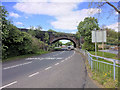
The lifestyle in L10 2LL is shaped by its proximity to retail, rail, and ferry services. Within practical reach are five retail venues, including major chains like Tesco Aintree, Morrisons Daily, and M&S Aintree, ensuring access to everyday shopping needs. The area’s railway stations—Old Roan, Aintree, and Fazakerley—offer connections to broader transport networks, while four ferry terminals provide maritime links to Liverpool, Belfast, and the Isle of Man. This mix of amenities supports both practical living and leisure activities, from grocery shopping to travel. The presence of these services suggests a community that values convenience and accessibility. While the area lacks parks or leisure facilities in the data, the transport options compensate by enabling residents to explore nearby attractions. The blend of retail and transport infrastructure makes daily life in L10 2LL efficient and varied.
Amenities
Schools
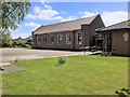
The nearest school to L10 2LL is Aintree Davenhill Primary School, which provides education for younger children. This primary school holds an Ofsted rating of ‘good’, indicating a satisfactory standard of teaching and facilities. The absence of secondary schools or other educational institutions in the data means that families may need to look beyond the immediate area for secondary education. However, the presence of a well-rated primary school is a significant draw for families with young children, as it reduces the need for long commutes. The single school listed suggests a limited educational infrastructure, but the quality of the existing school may mitigate this concern for some buyers. Parents should investigate further for secondary school options, though the primary school’s performance offers a solid foundation for early education.
| Rank | School | Type | Entry gender | Ages |
|---|
Explore more schools in this area
Go to Schools tabDemographics
The population of L10 2LL is 1,360, with a median age of 47. The majority of residents fall within the 30–64 age range, indicating a community of established adults. Home ownership is exceptionally high at 90%, suggesting a long-term presence of residents in their properties. The accommodation type is predominantly houses, reflecting a suburban or semi-rural character. The predominant ethnic group is White, which aligns with broader regional trends. This demographic profile implies a stable, low-turnover community where families and individuals prioritise security and familiarity. The absence of specific data on deprivation or diversity does not detract from the area’s practical appeal, though it underscores a homogenous social fabric. For buyers, this suggests a neighbourhood where property values are likely to remain steady, and community dynamics are predictable.
Household Size
Accommodation Type
Tenure
Ethnic Group
Religion
Household Composition
Age
Household Deprivation
NS-SEC
Explore more demographic insights in this area
Go to Demographics tabPlanning
Planning Constraints
- Flood RiskPremium
- Ramsar Wetland SitesPremium
- Area of Outstanding Natural BeautyPremium
- Protected Nature ReservePremium
- Protected WoodlandPremium