Area Overview for CW7 4DR
Photos of CW7 4DR

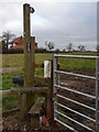

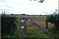
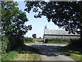

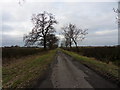
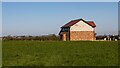


11 photos from this area
Area Information
Key information about the CW7 4DR including its size, population, and administrative classification.
- Area Type
- Postcode
- Area Size
- 2.7 km²
- Population
- 2058
- Population Density
- 53 people/km²
House Prices in CW7 4DR
30
Properties
£383,250
Average Sold Price
£320,000
Lowest Price
£466,250
Highest Price
Showing 30 properties
| Address | Type | Beds | Baths | Last Sale Price | Last Sale Date | |
|---|---|---|---|---|---|---|
| 3, Field House Court, Winsford Road, Cholmondeston, CW7 4DR | Semi-detached | 4 | 3 | £340,000 | Aug 2018 | |
| 4, Field House Court, Winsford Road, Cholmondeston, CW7 4DR | Semi-detached | 4 | 3 | £340,000 | May 2017 | |
| Greenfields, Winsford Road, Cholmondeston, CW7 4DR | Detached | 5 | 4 | £450,000 | Aug 2015 | |
| Barn Farm, Winsford Road, Cholmondeston, CW7 4DR | Detached | - | - | £466,250 | Apr 2009 | |
| 1, Field House Court, Winsford Road, Cholmondeston, CW7 4DR | Semi-detached | - | - | £320,000 | Oct 2007 | |
| Daisy Cottage, Winsford Road, Cholmondeston, CW7 4DR | Detached | - | - | - | - | |
| 2, Swallow Barn, Field House Court, Winsford Road, Cholmondeston, CW7 4DR | Semi-detached | - | - | - | - | |
| The Byre, Daisy Bank Farm, Winsford Road, Cholmondeston, CW7 4DR | Terraced | - | - | - | - | |
| Unit 3, Bridge Farm, Winsford Road, Cholmondeston, CW7 4DR | Industrial | - | - | - | - | |
| Unit 5, Bridge Farm, Winsford Road, Cholmondeston, CW7 4DR | Industrial | - | - | - | - |
Page 1 of 3
Energy Efficiency in CW7 4DR
Amenities
Schools
| Rank | School | Type | Entry gender | Ages |
|---|
Explore more schools in this area
Go to Schools tabDemographics
Household Size
Two person
most common
Accommodation Type
Houses
most common
Tenure
81
majority
Ethnic Group
White
most common
Religion
N/A
most common
Household Composition
N/A
most common
Age
47
median
Young Adults (15-29 years)
most common
Household Deprivation
N/A
with no deprivation
NS-SEC
29
in Lower managerial occupations
Explore more demographic insights in this area
Go to Demographics tabPlanning
Planning Constraints
- Flood RiskPremium
- Ramsar Wetland SitesPremium
- Area of Outstanding Natural BeautyPremium
- Protected Nature ReservePremium
- Protected WoodlandPremium