Area Overview for CW5 6AR
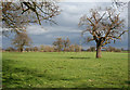
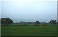
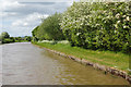
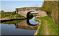
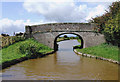
Photos of CW5 6AR
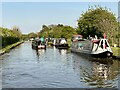
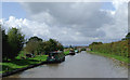
![Benyon's Bridge [No 4], Middlewich Branch in CW5 6AR](https://images.propbar.co.uk/images/geograph/52/11/5211818_120.jpg)
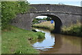
![Sandholes Bridge [No 3], Middlewich Branch in CW5 6AR](https://images.propbar.co.uk/images/geograph/52/11/5211821_120.jpg)

20 photos from this area
Area Information
Key information about the CW5 6AR including its size, population, and administrative classification.
- Area Type
- Postcode
- Area Size
- 53.6 hectares
- Population
- 2058
- Population Density
- 53 people/km²
House Prices in CW5 6AR
3
Properties
-
Average Sold Price
-
Lowest Price
-
Highest Price
Showing 3 properties
| Address | Type | Beds | Baths | Last Sale Price | Last Sale Date | |
|---|---|---|---|---|---|---|
| Stoke Lane Cottage, Stoke Hall Lane, Poole, CW5 6AR | Semi-detached | - | - | - | - | |
| Crossbanks Farm, Stoke Hall Lane, Poole, CW5 6AR | house | - | - | - | - | |
| Stokegate Cottage, 1 Stoke Hall Lane, Poole, CW5 6AR | Semi-detached | - | - | - | - |
Energy Efficiency in CW5 6AR
Amenities
Schools
| Rank | School | Type | Entry gender | Ages |
|---|
Explore more schools in this area
Go to Schools tabDemographics
Household Size
Two person
most common
Accommodation Type
Houses
most common
Tenure
81
majority
Ethnic Group
White
most common
Religion
N/A
most common
Household Composition
N/A
most common
Age
47
median
Young Adults (15-29 years)
most common
Household Deprivation
N/A
with no deprivation
NS-SEC
29
in Lower managerial occupations
Explore more demographic insights in this area
Go to Demographics tabPlanning
Planning Constraints
- Flood RiskPremium
- Ramsar Wetland SitesPremium
- Area of Outstanding Natural BeautyPremium
- Protected Nature ReservePremium
- Protected WoodlandPremium