Area Overview for CW7 4DP
Photos of CW7 4DP
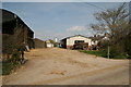
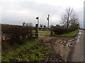
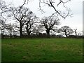
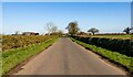
5 photos from this area
Area Information
Key information about the CW7 4DP including its size, population, and administrative classification.
- Area Type
- Postcode
- Area Size
- 57.7 hectares
- Population
- 2058
- Population Density
- 53 people/km²
House Prices in CW7 4DP
17
Properties
£382,492
Average Sold Price
£195,000
Lowest Price
£795,000
Highest Price
Showing 17 properties
| Address | Type | Beds | Baths | Last Sale Price | Last Sale Date | |
|---|---|---|---|---|---|---|
| 5, Crowton Cottages, Winsford Road, Cholmondeston, CW7 4DP | Semi-detached | 3 | - | £260,000 | Nov 2022 | |
| Ash View, Winsford Road, Cholmondeston, CW7 4DP | Semi-detached | 4 | 2 | £335,000 | Feb 2018 | |
| The Heathers, Winsford Road, Cholmondeston, CW7 4DP | Bungalow | - | - | £400,000 | Feb 2018 | |
| Oakfield House, Winsford Road, Cholmondeston, CW7 4DP | Detached | - | - | £795,000 | Aug 2008 | |
| Chapel View, Winsford Road, Cholmondeston, CW7 4DP | Semi-detached | - | - | £309,950 | Aug 2005 | |
| Brook Cottage, Winsford Road, Cholmondeston, CW7 4DP | Semi-detached | 3 | 2 | £195,000 | Jun 2004 | |
| 3, Crowton Cottages, Winsford Road, Cholmondeston, CW7 4DP | Semi-detached | 3 | - | - | - | |
| Quercus House, Winsford Road, Cholmondeston, CW7 4DP | house | 5 | - | - | - | |
| Brook Farm, Winsford Road, Cholmondeston, CW7 4DP | house | - | - | - | - | |
| 2, Crowton Cottages, Winsford Road, Cholmondeston, CW7 4DP | house | - | - | - | - |
Page 1 of 2
Energy Efficiency in CW7 4DP
Amenities
Schools
| Rank | School | Type | Entry gender | Ages |
|---|
Explore more schools in this area
Go to Schools tabDemographics
Household Size
Two person
most common
Accommodation Type
Houses
most common
Tenure
81
majority
Ethnic Group
White
most common
Religion
N/A
most common
Household Composition
N/A
most common
Age
47
median
Young Adults (15-29 years)
most common
Household Deprivation
N/A
with no deprivation
NS-SEC
29
in Lower managerial occupations
Explore more demographic insights in this area
Go to Demographics tabPlanning
Planning Constraints
- Flood RiskPremium
- Ramsar Wetland SitesPremium
- Area of Outstanding Natural BeautyPremium
- Protected Nature ReservePremium
- Protected WoodlandPremium