Area Overview for CW11 4HS
Photos of CW11 4HS
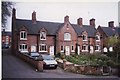
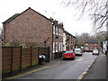

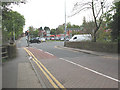
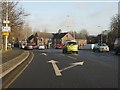


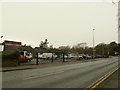
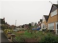
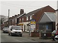
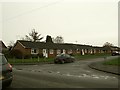
81 photos from this area
Area Information
Key information about the CW11 4HS including its size, population, and administrative classification.
- Area Type
- Postcode
- Area Size
- 2.6 hectares
- Population
- 1360
- Population Density
- 1109 people/km²
House Prices in CW11 4HS
46
Properties
£182,670
Average Sold Price
£63,250
Lowest Price
£275,000
Highest Price
Showing 46 properties
| Address | Type | Beds | Baths | Last Sale Price | Last Sale Date | |
|---|---|---|---|---|---|---|
| 41 Mortimer Drive, Sandbach, CW11 4HS | Bungalow | 2 | 3 | £275,000 | Jan 2023 | |
| 10 Mortimer Drive, Sandbach, CW11 4HS | house | - | - | £260,000 | Dec 2017 | |
| 26 Mortimer Drive, Sandbach, CW11 4HS | house | - | - | £190,000 | Aug 2014 | |
| 31 Mortimer Drive, Sandbach, CW11 4HS | house | - | - | £185,000 | Aug 2007 | |
| 35 Mortimer Drive, Sandbach, CW11 4HS | Detached | 4 | 2 | £223,000 | Aug 2007 | |
| 24 Mortimer Drive, Sandbach, CW11 4HS | Semi-detached | 3 | 2 | £173,000 | Feb 2006 | |
| 22 Mortimer Drive, Sandbach, CW11 4HS | house | 3 | 2 | £166,000 | Sep 2004 | |
| 45 Mortimer Drive, Sandbach, CW11 4HS | Detached | - | - | £138,950 | Jun 2004 | |
| 5 Mortimer Drive, Sandbach, CW11 4HS | house | - | - | £152,500 | Dec 2001 | |
| 33 Mortimer Drive, Sandbach, CW11 4HS | house | - | - | £63,250 | May 1996 |
Page 1 of 5
Energy Efficiency in CW11 4HS
Amenities
Schools
| Rank | School | Type | Entry gender | Ages |
|---|
Explore more schools in this area
Go to Schools tabDemographics
Household Size
Two person
most common
Accommodation Type
Houses
most common
Tenure
81
majority
Ethnic Group
White
most common
Religion
N/A
most common
Household Composition
N/A
most common
Age
47
median
Adults (30-64 years)
most common
Household Deprivation
N/A
with no deprivation
NS-SEC
40
in Lower managerial occupations
Explore more demographic insights in this area
Go to Demographics tabPlanning
Planning Constraints
- Flood RiskPremium
- Ramsar Wetland SitesPremium
- Area of Outstanding Natural BeautyPremium
- Protected Nature ReservePremium
- Protected WoodlandPremium