Area Overview for CW11 4HN
Photos of CW11 4HN
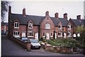
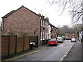


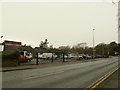
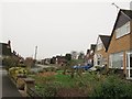
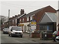
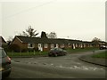
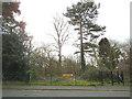
81 photos from this area
Area Information
Key information about the CW11 4HN including its size, population, and administrative classification.
- Area Type
- Postcode
- Area Size
- 2.5 hectares
- Population
- 1360
- Population Density
- 1109 people/km²
House Prices in CW11 4HN
54
Properties
£248,808
Average Sold Price
£81,950
Lowest Price
£575,000
Highest Price
Showing 54 properties
| Address | Type | Beds | Baths | Last Sale Price | Last Sale Date | |
|---|---|---|---|---|---|---|
| 46 Hassall Road, Sandbach, CW11 4HN | Semi-detached | 2 | 2 | £278,356 | Sep 2025 | |
| 72 Hassall Road, Sandbach, CW11 4HN | Terraced | 2 | 1 | £269,000 | Apr 2025 | |
| 66 Hassall Road, Sandbach, CW11 4HN | Terraced | 2 | 1 | £243,000 | Mar 2025 | |
| 90 Hassall Road, Sandbach, CW11 4HN | Semi-detached | 2 | 2 | £273,000 | Mar 2025 | |
| 92 Hassall Road, Sandbach, CW11 4HN | Semi-detached | 2 | 1 | £240,000 | Dec 2024 | |
| 55 Hassall Road, Sandbach, CW11 4HN | Semi-detached | 4 | 2 | £400,000 | Nov 2024 | |
| 74 Hassall Road, Sandbach, CW11 4HN | Terraced | 2 | 1 | £280,000 | Oct 2024 | |
| 100 Hassall Road, Sandbach, CW11 4HN | house | - | - | £172,500 | Apr 2024 | |
| 70 Hassall Road, Sandbach, CW11 4HN | Terraced | 2 | 1 | £238,000 | Jan 2024 | |
| 43 Hassall Road, Sandbach, CW11 4HN | Bungalow | 3 | 1 | £300,000 | Nov 2023 |
Page 1 of 6
Energy Efficiency in CW11 4HN
Amenities
Schools
| Rank | School | Type | Entry gender | Ages |
|---|
Explore more schools in this area
Go to Schools tabDemographics
Household Size
Two person
most common
Accommodation Type
Houses
most common
Tenure
81
majority
Ethnic Group
White
most common
Religion
N/A
most common
Household Composition
N/A
most common
Age
47
median
Adults (30-64 years)
most common
Household Deprivation
N/A
with no deprivation
NS-SEC
40
in Lower managerial occupations
Explore more demographic insights in this area
Go to Demographics tabPlanning
Planning Constraints
- Flood RiskPremium
- Ramsar Wetland SitesPremium
- Area of Outstanding Natural BeautyPremium
- Protected Nature ReservePremium
- Protected WoodlandPremium