Area Overview for CH61 3UW
Photos of CH61 3UW
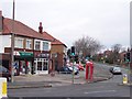
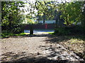
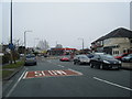
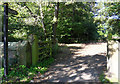

12 photos from this area
Area Information
Key information about the CH61 3UW including its size, population, and administrative classification.
- Area Type
- Postcode
- Area Size
- 1.0 hectares
- Population
- 1450
- Population Density
- 2534 people/km²
House Prices in CH61 3UW
19
Properties
£202,776
Average Sold Price
£47,700
Lowest Price
£360,000
Highest Price
Showing 19 properties
| Address | Type | Beds | Baths | Last Sale Price | Last Sale Date | |
|---|---|---|---|---|---|---|
| 78 Whaley Lane, Irby, CH61 3UW | Terraced | 3 | 1 | £190,000 | Dec 2024 | |
| 62B Whaley Lane, Irby, CH61 3UW | Semi-detached | 2 | 1 | £200,000 | Apr 2024 | |
| 66 Whaley Lane, Irby, CH61 3UW | house | - | - | £215,000 | Oct 2023 | |
| 62A Whaley Lane, Irby, CH61 3UW | house | - | - | £325,000 | Mar 2023 | |
| Emdon, 47 Whaley Lane, Irby, CH61 3UW | Semi-detached | 3 | - | £270,000 | Dec 2021 | |
| 74 Whaley Lane, Irby, CH61 3UW | house | - | - | £175,000 | Jun 2021 | |
| 76 Whaley Lane, Irby, CH61 3UW | Terraced | 3 | 1 | £147,000 | Aug 2019 | |
| 80 Whaley Lane, Irby, CH61 3UW | house | - | - | £175,000 | Oct 2018 | |
| 68 Whaley Lane, Irby, CH61 3UW | Terraced | - | - | £149,950 | Sep 2015 | |
| 72 Whaley Lane, Irby, CH61 3UW | house | - | - | £130,000 | Mar 2015 |
Page 1 of 2
Energy Efficiency in CH61 3UW
Amenities
Schools
| Rank | School | Type | Entry gender | Ages |
|---|
Explore more schools in this area
Go to Schools tabDemographics
Household Size
Two person
most common
Accommodation Type
Houses
most common
Tenure
78
majority
Ethnic Group
White
most common
Religion
N/A
most common
Household Composition
N/A
most common
Age
47
median
Adults (30-64 years)
most common
Household Deprivation
N/A
with no deprivation
NS-SEC
37
in Lower managerial occupations
Explore more demographic insights in this area
Go to Demographics tabPlanning
Planning Constraints
- Flood RiskPremium
- Ramsar Wetland SitesPremium
- Area of Outstanding Natural BeautyPremium
- Protected Nature ReservePremium
- Protected WoodlandPremium