Area Overview for CH61 3UT
Photos of CH61 3UT

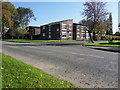
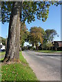
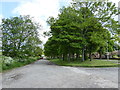
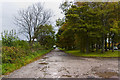
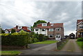

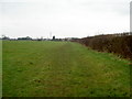
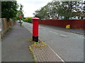
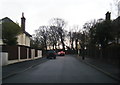
13 photos from this area
Area Information
Key information about the CH61 3UT including its size, population, and administrative classification.
- Area Type
- Postcode
- Area Size
- 2.1 hectares
- Population
- 1450
- Population Density
- 2534 people/km²
House Prices in CH61 3UT
25
Properties
£277,583
Average Sold Price
£75,000
Lowest Price
£535,000
Highest Price
Showing 25 properties
| Address | Type | Beds | Baths | Last Sale Price | Last Sale Date | |
|---|---|---|---|---|---|---|
| Townsend, 29 Whaley Lane, Irby, CH61 3UT | Bungalow | 2 | 1 | £278,500 | Jan 2025 | |
| The Sarn, 33 Whaley Lane, Irby, CH61 3UT | house | 4 | 2 | £407,000 | Dec 2024 | |
| 15 Whaley Lane, Irby, CH61 3UT | Bungalow | 3 | 1 | £330,000 | Jun 2023 | |
| 5 Whaley Lane, Irby, CH61 3UT | house | - | - | £535,000 | Jun 2022 | |
| Ashcroft, 37 Whaley Lane, Irby, CH61 3UT | house | - | - | £362,500 | Feb 2022 | |
| Strathcona, 25 Whaley Lane, Irby, CH61 3UT | Bungalow | - | - | £270,000 | Oct 2021 | |
| Sherbrook, 23 Whaley Lane, Irby, CH61 3UT | Detached | - | - | £327,000 | Aug 2009 | |
| 27 Whaley Lane, Irby, CH61 3UT | Detached | - | - | £248,000 | Jul 2006 | |
| 33A Whaley Lane, Irby, CH61 3UT | Detached | 4 | 2 | £235,000 | Jul 2005 | |
| 21 Whaley Lane, Irby, CH61 3UT | Detached | - | - | £160,000 | Feb 2005 |
Page 1 of 3
Energy Efficiency in CH61 3UT
Amenities
Schools
| Rank | School | Type | Entry gender | Ages |
|---|
Explore more schools in this area
Go to Schools tabDemographics
Household Size
Two person
most common
Accommodation Type
Houses
most common
Tenure
78
majority
Ethnic Group
White
most common
Religion
N/A
most common
Household Composition
N/A
most common
Age
47
median
Adults (30-64 years)
most common
Household Deprivation
N/A
with no deprivation
NS-SEC
37
in Lower managerial occupations
Explore more demographic insights in this area
Go to Demographics tabPlanning
Planning Constraints
- Flood RiskPremium
- Ramsar Wetland SitesPremium
- Area of Outstanding Natural BeautyPremium
- Protected Nature ReservePremium
- Protected WoodlandPremium