Area Overview for CH61 3XH
Photos of CH61 3XH

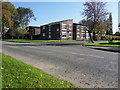
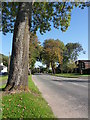
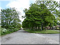
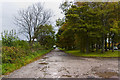
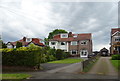

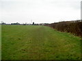
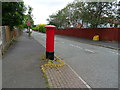
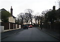
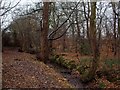
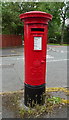
13 photos from this area
Area Information
Key information about the CH61 3XH including its size, population, and administrative classification.
- Area Type
- Postcode
- Area Size
- 1.3 hectares
- Population
- 1450
- Population Density
- 2534 people/km²
House Prices in CH61 3XH
19
Properties
£268,962
Average Sold Price
£87,000
Lowest Price
£420,000
Highest Price
Showing 19 properties
| Address | Type | Beds | Baths | Last Sale Price | Last Sale Date | |
|---|---|---|---|---|---|---|
| 2 Barker Road, Irby, CH61 3XH | Bungalow | - | - | £325,000 | Nov 2022 | |
| 16 Barker Road, Irby, CH61 3XH | Bungalow | - | - | £355,000 | Feb 2021 | |
| 3B Barker Road, Irby, CH61 3XH | house | - | - | £420,000 | Nov 2020 | |
| Shiloh, 10 Barker Road, Irby, CH61 3XH | Bungalow | - | - | £325,000 | Aug 2020 | |
| 15 Barker Road, Irby, CH61 3XH | Bungalow | - | - | £245,000 | May 2019 | |
| 3 Barker Road, Irby, CH61 3XH | Bungalow | 3 | - | £405,000 | Dec 2018 | |
| 3A Barker Road, Irby, CH61 3XH | house | - | - | £412,500 | Oct 2018 | |
| 4 Barker Road, Irby, CH61 3XH | Detached | - | - | £230,000 | Jul 2016 | |
| 5 Barker Road, Irby, CH61 3XH | Detached | - | - | £180,000 | Jan 2015 | |
| 13 Barker Road, Irby, CH61 3XH | Detached | - | - | £160,000 | Apr 2005 |
Page 1 of 2
Energy Efficiency in CH61 3XH
Amenities
Schools
| Rank | School | Type | Entry gender | Ages |
|---|
Explore more schools in this area
Go to Schools tabDemographics
Household Size
Two person
most common
Accommodation Type
Houses
most common
Tenure
78
majority
Ethnic Group
White
most common
Religion
N/A
most common
Household Composition
N/A
most common
Age
47
median
Adults (30-64 years)
most common
Household Deprivation
N/A
with no deprivation
NS-SEC
37
in Lower managerial occupations
Explore more demographic insights in this area
Go to Demographics tabPlanning
Planning Constraints
- Flood RiskPremium
- Ramsar Wetland SitesPremium
- Area of Outstanding Natural BeautyPremium
- Protected Nature ReservePremium
- Protected WoodlandPremium