Area Overview for CH61 9QE
Photos of CH61 9QE
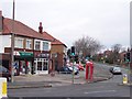
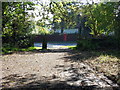
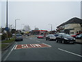
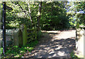

12 photos from this area
Area Information
Key information about the CH61 9QE including its size, population, and administrative classification.
- Area Type
- Postcode
- Area Size
- 4490 m²
- Population
- 1450
- Population Density
- 2534 people/km²
House Prices in CH61 9QE
13
Properties
£160,650
Average Sold Price
£68,000
Lowest Price
£310,000
Highest Price
Showing 13 properties
| Address | Type | Beds | Baths | Last Sale Price | Last Sale Date | |
|---|---|---|---|---|---|---|
| 127 Kings Drive, Irby, CH61 9QE | house | - | - | £205,000 | Jun 2025 | |
| 111 Kings Drive, Irby, CH61 9QE | house | - | - | £201,000 | Feb 2023 | |
| 123 Kings Drive, Irby, CH61 9QE | Flat | 1 | 1 | £118,000 | Aug 2022 | |
| 135 Kings Drive, Irby, CH61 9QE | house | - | - | £310,000 | Feb 2022 | |
| 133 Kings Drive, Irby, CH61 9QE | Semi-detached | 3 | 1 | £195,000 | Sep 2020 | |
| 119 Kings Drive, Irby, CH61 9QE | Flat | - | - | £68,000 | Mar 2014 | |
| 131 Kings Drive, Irby, CH61 9QE | Semi-detached | 3 | 1 | £157,500 | Jul 2007 | |
| 115 Kings Drive, Irby, CH61 9QE | Semi-detached | - | - | £137,000 | Oct 2004 | |
| 113 Kings Drive, Irby, CH61 9QE | Semi-detached | - | - | £130,000 | Sep 2004 | |
| 117 Kings Drive, Irby, CH61 9QE | Semi-detached | - | - | £85,000 | Oct 2002 |
Page 1 of 2
Energy Efficiency in CH61 9QE
Amenities
Schools
| Rank | School | Type | Entry gender | Ages |
|---|
Explore more schools in this area
Go to Schools tabDemographics
Household Size
Two person
most common
Accommodation Type
Houses
most common
Tenure
78
majority
Ethnic Group
White
most common
Religion
N/A
most common
Household Composition
N/A
most common
Age
47
median
Adults (30-64 years)
most common
Household Deprivation
N/A
with no deprivation
NS-SEC
37
in Lower managerial occupations
Explore more demographic insights in this area
Go to Demographics tabPlanning
Planning Constraints
- Flood RiskPremium
- Ramsar Wetland SitesPremium
- Area of Outstanding Natural BeautyPremium
- Protected Nature ReservePremium
- Protected WoodlandPremium