Area Overview for CH2 3DQ
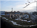
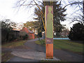
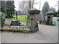
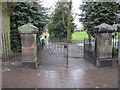
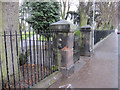
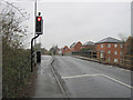
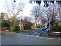
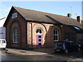
Photos of CH2 3DQ
Area Information
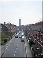
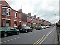
Living in CH2 3DQ means inhabiting a small, densely populated residential cluster in Chester, Cheshire. The area spans 714 square metres and is home to 1,528 people, translating to a population density of over 2 million per square kilometre. This compact postcode reflects a suburban and residential character shaped by 19th- and early 20th-century development. The area’s historical roots are evident in its Victorian and interwar housing stock, with landmarks like Newton Hollows—a 506-metre ancient hollow way—adding cultural depth. Residents benefit from proximity to Chester’s urban centre, with easy access to rail networks and retail hubs. The community is defined by its mix of local shopping streets and public amenities, while historical infrastructure, such as Hoole Urban District’s former headquarters, underscores its legacy. For those seeking a blend of heritage and modern convenience, CH2 3DQ offers a compact, tightly knit environment with clear connections to the city’s broader networks.
- Area Type
- Postcode
- Area Size
- 714 m²
- Population
- 1528
- Population Density
- 5341 people/km²
The property market in CH2 3DQ is characterised by a low home ownership rate—34% of residents own their homes—suggesting a market dominated by rental properties. The accommodation type is primarily houses, which may appeal to families seeking space in a compact area. However, the small size of the postcode (714 m²) and its dense population imply limited housing diversity. Buyers should consider that the area’s property stock is largely historic, with Victorian and interwar-era homes forming the bulk of the market. This could mean lower availability of modern housing or newer developments. For those prioritising proximity to Chester’s amenities, the area’s location offers convenience, but the limited size may restrict options for those seeking larger properties or alternative housing types. Potential buyers should also note the moderate crime risk, which may influence perceptions of safety and desirability.
House Prices in CH2 3DQ
No properties found in this postcode.
Energy Efficiency in CH2 3DQ
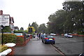
Life in CH2 3DQ is shaped by its proximity to retail, transport, and historical sites. Local shops include Sainsburys Chester, Co-op Chester, and Morrisons Daily, providing everyday essentials within walking distance. The area’s rail network connects residents to Chester’s main stations and beyond, while Hawarden Airport offers regional air travel options. The Newton Hollows, a historic public footpath, adds a unique cultural dimension, blending leisure with heritage. The compact layout ensures amenities are easily accessible, reducing the need for lengthy commutes. For residents, this means a balance of convenience and character, with local shopping, transport links, and historical landmarks contributing to a distinct lifestyle. The area’s small size fosters a sense of community, though the high population density may influence the pace of daily life.
Amenities
Schools
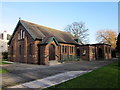
Residents of CH2 3DQ have access to two notable schools. St Werburgh’s and St Columba’s Catholic Primary School, a primary school with a ‘good’ Ofsted rating, serves younger children, while St Martin’s Academy Chester, an academy with an ‘outstanding’ rating, caters to older students. The combination of a primary school and a high-performing academy offers families a range of educational choices, from early years to secondary education. Both institutions are within practical reach, reducing the need for long commutes. The presence of a top-rated academy may be particularly appealing to families prioritising academic excellence. However, the area’s small size means school catchment areas are likely tightly defined, requiring careful consideration of proximity when selecting a home.
| Rank | School | Type | Entry gender | Ages |
|---|
Explore more schools in this area
Go to Schools tabDemographics
The population of CH2 3DQ has a median age of 47, with the majority of residents aged 30–64. This suggests a community skewed toward middle-aged adults, likely including families and professionals. Home ownership stands at 34%, indicating a significant proportion of residents are renters, possibly due to the area’s compact size and limited housing stock. The accommodation type is predominantly houses, which may reflect the area’s historical development as a suburban extension of Chester. The predominant ethnic group is White, though specific diversity metrics are not provided. With a population density of over 2 million per square kilometre, the area is intensely populated, which may influence daily life through proximity to neighbours and shared amenities. The demographic profile hints at a stable, established community, though the lower home ownership rate could signal a reliance on rental markets or transient populations.
Household Size
Accommodation Type
Tenure
Ethnic Group
Religion
Household Composition
Age
Household Deprivation
NS-SEC
Explore more demographic insights in this area
Go to Demographics tabPlanning
Planning Constraints
- Flood RiskPremium
- Ramsar Wetland SitesPremium
- Area of Outstanding Natural BeautyPremium
- Protected Nature ReservePremium
- Protected WoodlandPremium