Area Overview for CH2 3BB
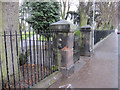
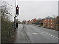
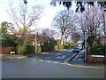
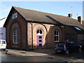
Photos of CH2 3BB
Area Information
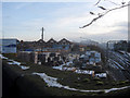
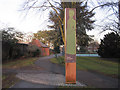
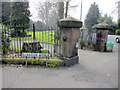
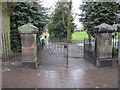
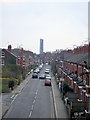
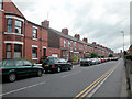
CH2 3BB represents a specific residential postcode within the Newton and Hoole Ward of Chester, Cheshire. This compact cluster covers an area of 6,076 square metres and is home to a population of 1,528 people. The location sits within the historic context of a district that expanded significantly during the 19th and early 20th centuries. You are stepping into a neighbourhood defined by Victorian and interwar housing stock and local shopping streets. The area retains strong historical roots, with the settlement first mentioned in 1119 in the Register of the Abbey of Saint Werburgh. Daily life here revolves around the unique heritage of Newton Hollows, an ancient Roman roadway that now serves as a public footpath. This 506-metre walkable section stretches from Newton Lane to the Fairfield Road footbridge. The modern Ermine Public House stands on the site where the fraternity of St. Anne's once erected a protective cross in the mid-12th century. While the original turnpike road was abandoned in the 18th century, the area remains connected by Hoole Road and the A41 administrative boundary. Living in CH2 3BB offers proximity to the city centre while maintaining a distinct suburban character shaped by over a millennium of history. The area balances its industrial past, born from railway and canal commerce, with a quiet, residential present characterised by heritage elements and structured planning.
- Area Type
- Postcode
- Area Size
- 6076 m²
- Population
- 1528
- Population Density
- 5341 people/km²
The property market in CH2 3BB is defined by a small residential cluster that houses 1,528 people across an area of just 6,076 square metres. With home ownership at 34%, the area likely contains a significant number of rental properties alongside owner-occupied homes. The dominant accommodation type is houses, which aligns with the Victorian and interwar housing stock that characterises the wider Newton and Hoole Ward. They look for traditional family homes rather than contemporary developments or luxury apartments. This layout implies a market focused on existing structures rather than new builds. The historical context of the area, including its origins as part of Hoole Urban District before the 1954 absorption into Chester, suggests a stock of buildings with varying ages and maintenance histories. Buyers seeking homes in CH2 3BB should expect a mixture of properties that require appreciation of older construction methods. The 34% ownership rate indicates a competitive rental sector where landlords may choose properties with lower maintenance needs or those closer to the city centre amenities. The small size of the postcode means supply will be limited, creating a niche market for those specifically targeting this historical pocket of Chester.
House Prices in CH2 3BB
Showing 31 properties
| Address | Type | Beds | Baths | Last Sale Price | Last Sale Date | |
|---|---|---|---|---|---|---|
| 20 Westminster Road, Chester, CH2 3BB | Terraced | 2 | 1 | £310,000 | Mar 2025 | |
| 6 Westminster Road, Chester, CH2 3BB | house | - | - | £430,000 | Nov 2022 | |
| 22 Westminster Road, Chester, CH2 3BB | Terraced | 2 | 1 | £280,000 | Aug 2022 | |
| 26 Westminster Road, Chester, CH2 3BB | house | - | - | £286,000 | Jan 2021 | |
| 28 Westminster Road, Chester, CH2 3BB | Terraced | 2 | 1 | £260,000 | Mar 2018 | |
| 11 Westminster Road, Chester, CH2 3BB | house | - | - | £150,000 | Aug 2009 | |
| Lilac House, 10 Westminster Road, Chester, CH2 3BB | Terraced | 3 | 1 | £125,000 | Oct 2003 | |
| 1 Westminster Road, Chester, CH2 3BB | Terraced | 2 | 1 | £132,000 | Apr 2003 | |
| 24 Westminster Road, Chester, CH2 3BB | Terraced | - | - | £114,000 | Mar 2002 | |
| 23 Westminster Road, Chester, CH2 3BB | Terraced | - | - | £105,000 | Mar 2002 |
Energy Efficiency in CH2 3BB
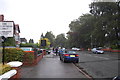
Residents of CH2 3BB enjoy immediate access to a range of retail and leisure amenities within practical reach. The neighbourhood is surrounded by five retail establishments, including notable venues such as Sainsburys Chester, Co-op Chester, and Morrisons Daily. These supermarkets are essential for daily shopping needs and form the backbone of local commerce. For those preferring physical access to goods, these stores provide a convenient selection of groceries and household essentials without requiring long journeys into the city centre. Transport links further enhance lifestyle convenience, with five railway stations nearby, specifically Chester Railway Station, Bache Railway Station, and Capenhurst Railway Station. The local area also connects to Hawarden Airport, offering rare regional air travel options for flyers located in this residential cluster. Newton Hollows provides a accessible green space, featuring a 506-metre walkable section of an ancient hollow way. The historic Ermine Public House stands on the site of a 12th-century protective cross, adding a unique dining and leisure element to the local scene. Living in CH2 3BB balances suburban utility with historical charm, offering residents a mix of practical shopping, reliable transport, and community-focused leisure activities.
Amenities
Schools
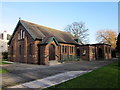
Families considering homes in CH2 3BB have access to two specific educational institutions within close proximity. St Werburgh's and St Columba's Catholic Primary School operates as a primary school with a good Ofsted rating. The area also benefits from St Martin's Academy Chester, which functions as an academy school. This combination of sector types provides options for both state and faith-based education, though the data specifies ratings only for these two locations. The presence of a good-rated primary school and an academy suggests an educational standard that meets or exceeds national expectations. You do not find outstanding primary schools listed, but the excellent rating at the academy level indicates strong secondary education potential nearby. For children moving into this area, the commute likely remains short given the description of these schools as being nearest to the postcode. The mix of school types means parents can choose between the structured environment of the Catholic primary school or the broader curriculum of the academy. Both institutions contribute to the local education landscape, ensuring that living in CH2 3BB provides reasonable access to formal schooling for young residents.
| Rank | School | Type | Entry gender | Ages |
|---|
Explore more schools in this area
Go to Schools tabDemographics
The community in CH2 3BB is dominated by adults, with the most common age range falling between 30 and 64 years. The median age for residents is 47, indicating a mature population profile. This demographic structure suggests an area populated by established households rather than young professionals or students. Home ownership stands at 34%, meaning roughly one-third of residents occupy their own property, while the remaining two-thirds rent their accommodation. The local housing stock consists predominantly of houses, distinguishing this postcode from areas characterised by high-rise flats or luxury apartments. You will not find a diverse mix of lifestyle complexes here; instead, the landscape is uniform in its residential nature. The predominant ethnic group in the area is White, reflecting the traditional settlement patterns of the Newton and Hoole wards. There are no signs of significant recent migration or demographic shifts that would alter this established profile. The low population density relative to the small footprint of 6,076 square metres indicates a tightly knit environment where neighbours likely know one another. This consistency in age and housing type creates a stable but potentially homogenous social environment for anyone considering homes in CH2 3BB.
Household Size
Accommodation Type
Tenure
Ethnic Group
Religion
Household Composition
Age
Household Deprivation
NS-SEC
Explore more demographic insights in this area
Go to Demographics tabPlanning
Planning Constraints
- Flood RiskPremium
- Ramsar Wetland SitesPremium
- Area of Outstanding Natural BeautyPremium
- Protected Nature ReservePremium
- Protected WoodlandPremium