Area Overview for BB2 7PU
Photos of BB2 7PU
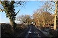
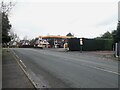
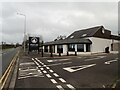
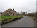
17 photos from this area
Area Information
Key information about the BB2 7PU including its size, population, and administrative classification.
- Area Type
- Postcode
- Area Size
- 53.8 hectares
- Population
- 1187
- Population Density
- 59 people/km²
House Prices in BB2 7PU
38
Properties
£334,883
Average Sold Price
£58,000
Lowest Price
£745,000
Highest Price
Showing 38 properties
| Address | Type | Beds | Baths | Last Sale Price | Last Sale Date | |
|---|---|---|---|---|---|---|
| Kirn, Preston New Road, Mellor Brook, BB2 7PU | Detached | 6 | 2 | £745,000 | Aug 2025 | |
| Head Of Lea, Preston New Road, Mellor Brook, BB2 7PU | Detached | 3 | 1 | £510,000 | Jun 2025 | |
| Suestra, Preston New Road, Mellor Brook, BB2 7PU | Bungalow | 3 | 1 | £250,000 | Feb 2025 | |
| Highfield, Preston New Road, Mellor Brook, BB2 7PU | Detached | 5 | 3 | £600,000 | Feb 2025 | |
| Mandria, Preston New Road, Mellor Brook, BB2 7PU | Detached | 4 | 2 | £492,500 | Oct 2024 | |
| Mayfield, Preston New Road, Mellor Brook, BB2 7PU | Detached | 3 | 2 | £472,000 | Apr 2024 | |
| Lower Intack Barn, Preston New Road, Mellor Brook, BB2 7PU | Semi-detached | 4 | 2 | £730,000 | Oct 2023 | |
| Quennevais, Preston New Road, Mellor Brook, BB2 7PU | Bungalow | 3 | 2 | £410,000 | Oct 2023 | |
| Oakdene, Preston New Road, Mellor Brook, BB2 7PU | Bungalow | 3 | 2 | £450,000 | Apr 2023 | |
| Dale End, Preston New Road, Mellor Brook, BB2 7PU | Detached | 4 | 1 | £440,000 | Nov 2020 |
Page 1 of 4
Energy Efficiency in BB2 7PU
Amenities
Schools
| Rank | School | Type | Entry gender | Ages |
|---|
Explore more schools in this area
Go to Schools tabDemographics
Household Size
Two person
most common
Accommodation Type
Houses
most common
Tenure
84
majority
Ethnic Group
White
most common
Religion
N/A
most common
Household Composition
N/A
most common
Age
47
median
Adults (30-64 years)
most common
Household Deprivation
N/A
with no deprivation
NS-SEC
42
in Lower managerial occupations
Explore more demographic insights in this area
Go to Demographics tabPlanning
Planning Constraints
- Flood RiskPremium
- Ramsar Wetland SitesPremium
- Area of Outstanding Natural BeautyPremium
- Protected Nature ReservePremium
- Protected WoodlandPremium