Area Overview for BB2 7NY
Photos of BB2 7NY
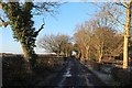
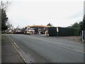
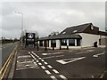
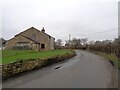
17 photos from this area
Area Information
Key information about the BB2 7NY including its size, population, and administrative classification.
- Area Type
- Postcode
- Area Size
- 11.1 hectares
- Population
- 1187
- Population Density
- 59 people/km²
House Prices in BB2 7NY
54
Properties
£251,090
Average Sold Price
£58,000
Lowest Price
£675,000
Highest Price
Showing 54 properties
| Address | Type | Beds | Baths | Last Sale Price | Last Sale Date | |
|---|---|---|---|---|---|---|
| 109 Branch Road, Mellor, BB2 7NY | Bungalow | 3 | 3 | £340,000 | Oct 2025 | |
| 103 Branch Road, Mellor, BB2 7NY | Bungalow | 3 | 2 | £410,000 | Jun 2025 | |
| 65 Branch Road, Mellor, BB2 7NY | Semi-detached | 3 | 2 | £295,000 | Jan 2024 | |
| 45 Branch Road, Mellor, BB2 7NY | Semi-detached | 3 | 1 | £263,000 | Dec 2023 | |
| 111 Branch Road, Mellor, BB2 7NY | Bungalow | 3 | 2 | £440,000 | Nov 2023 | |
| 60 Branch Road, Mellor, BB2 7NY | Detached | 5 | 3 | £675,000 | Aug 2023 | |
| 43 Branch Road, Mellor, BB2 7NY | Semi-detached | 3 | 1 | £300,000 | Jun 2023 | |
| 101 Branch Road, Mellor, BB2 7NY | Bungalow | 4 | 1 | £340,000 | Apr 2023 | |
| 46A Branch Road, Mellor, BB2 7NY | house | - | - | £297,500 | Oct 2022 | |
| 72 Branch Road, Mellor, BB2 7NY | Semi-detached | 3 | 1 | £246,000 | Feb 2022 |
Page 1 of 6
Energy Efficiency in BB2 7NY
Amenities
Schools
| Rank | School | Type | Entry gender | Ages |
|---|
Explore more schools in this area
Go to Schools tabDemographics
Household Size
Two person
most common
Accommodation Type
Houses
most common
Tenure
84
majority
Ethnic Group
White
most common
Religion
N/A
most common
Household Composition
N/A
most common
Age
47
median
Adults (30-64 years)
most common
Household Deprivation
N/A
with no deprivation
NS-SEC
42
in Lower managerial occupations
Explore more demographic insights in this area
Go to Demographics tabPlanning
Planning Constraints
- Flood RiskPremium
- Ramsar Wetland SitesPremium
- Area of Outstanding Natural BeautyPremium
- Protected Nature ReservePremium
- Protected WoodlandPremium