Area Overview for BB12 8DT
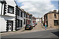
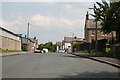
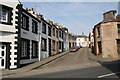
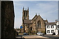
Photos of BB12 8DT
Area Information
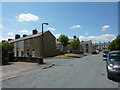
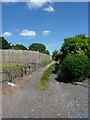
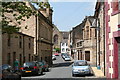
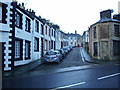
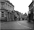
BB12 8DT lies in the heart of Padiham, a small market town in Lancashire’s Burnley Borough. This postcode area covers 3,922 square metres, housing 1,623 residents in a densely populated cluster. The area’s compact size reflects its historic role as a market town, with roots tracing back to the Anglo-Saxon era. Padiham’s centre is designated a conservation area, preserving its 19th-century architecture and heritage. The town’s proximity to Pendle Hill and the River Calder offers a blend of natural and industrial history, from its medieval mills to 20th-century coal mining. Today, daily life here is shaped by its small-town charm, with local amenities and rail links connecting it to Burnley and beyond. The high population density—413,783 people per square kilometre—means the community is tightly knit, though the area’s limited size means residents often rely on nearby towns for broader services. For those seeking a compact, historically rich environment with practical connectivity, BB12 8DT offers a distinct mix of tradition and accessibility.
- Area Type
- Postcode
- Area Size
- 3922 m²
- Population
- 1623
- Population Density
- 4332 people/km²
BB12 8DT’s property market is defined by its 43% home ownership rate, with houses making up the majority of accommodation types. This suggests a focus on family homes rather than apartments or flats, which are less common in the area. The limited size of the postcode—just 3,922 square metres—means the housing stock is concentrated, potentially leading to competition for properties. The high population density, at 413,783 people per square kilometre, further implies that the area is fully built out, with little scope for new developments. For buyers, this means the market is likely to be tight, with limited options for expansion or new builds. The presence of historic homes, such as those in the conservation area, may appeal to those seeking character properties, though the small size of the area means buyers must consider proximity to nearby towns for additional amenities. The market is likely to cater to those prioritising established communities over growth potential.
House Prices in BB12 8DT
Showing 15 properties
| Address | Type | Beds | Baths | Last Sale Price | Last Sale Date | |
|---|---|---|---|---|---|---|
| 2 Partridge Hill Street, Padiham, BB12 8DT | Terraced | 2 | 1 | £100,000 | May 2025 | |
| 12 Partridge Hill Street, Padiham, BB12 8DT | Terraced | 2 | 1 | £107,000 | Mar 2025 | |
| 4 Partridge Hill Street, Padiham, BB12 8DT | Terraced | 2 | 1 | £110,200 | Nov 2024 | |
| 9 Partridge Hill Street, Padiham, BB12 8DT | Terraced | 2 | 1 | £70,000 | Oct 2024 | |
| 1 Partridge Hill Street, Padiham, BB12 8DT | Terraced | 2 | 1 | £99,950 | Dec 2023 | |
| 6 Partridge Hill Street, Padiham, BB12 8DT | house | - | - | £70,500 | Jun 2021 | |
| 11 Partridge Hill Street, Padiham, BB12 8DT | house | 2 | 1 | £57,500 | May 2020 | |
| 13 Partridge Hill Street, Padiham, BB12 8DT | Terraced | 2 | - | £38,000 | Oct 2014 | |
| 7 Partridge Hill Street, Padiham, BB12 8DT | house | 2 | - | £51,000 | Jan 2006 | |
| 10 Partridge Hill Street, Padiham, BB12 8DT | Terraced | 2 | 1 | £69,000 | Aug 2005 |
Energy Efficiency in BB12 8DT
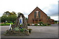
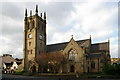
Living in BB12 8DT offers access to a range of local amenities, including five retail outlets such as Lidl Padiham, Tesco Padiham, and Spar, providing everyday shopping convenience. The area’s rail network is well-served, with five nearby stations, including Hapton and Burnley Barracks, facilitating easy travel to Burnley and surrounding areas. Historically, Padiham was a market town, and this legacy persists in its mix of practical retail and transport links. While the area lacks large-scale leisure facilities, its proximity to Pendle Hill and the River Calder offers opportunities for outdoor activities. The conservation area status of Padiham’s town centre adds a layer of historical interest, with landmarks like St Leonard’s Parish Church and Victoria Mill. For residents, this blend of small-town practicality and preserved heritage creates a lifestyle that balances convenience with character, though larger amenities may require trips to nearby towns.
Amenities
Schools
| Rank | School | Type | Entry gender | Ages |
|---|
Explore more schools in this area
Go to Schools tabDemographics
The population of BB12 8DT is predominantly middle-aged, with a median age of 47 and 30–64-year-olds forming the largest age group. Home ownership stands at 43%, indicating a mix of owner-occupied and rental properties. The area is characterised by houses rather than flats, reflecting a family-oriented housing stock. The predominant ethnic group is White, aligning with broader trends in the region. The high population density—413,783 people per square kilometre—suggests a compact, closely packed community, though this does not necessarily correlate with deprivation levels. However, the data does not provide specific metrics on deprivation, so it is difficult to assess how this density impacts quality of life. The age profile and housing type suggest a stable, long-term resident base, with limited turnover. For buyers, this demographic profile indicates a mature, settled community with established social networks, though the high density may influence property availability and competition.
Household Size
Accommodation Type
Tenure
Ethnic Group
Religion
Household Composition
Age
Household Deprivation
NS-SEC
Explore more demographic insights in this area
Go to Demographics tabPlanning
Planning Constraints
- Flood RiskPremium
- Ramsar Wetland SitesPremium
- Area of Outstanding Natural BeautyPremium
- Protected Nature ReservePremium
- Protected WoodlandPremium