Area Overview for BB12 8DN
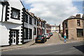
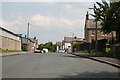
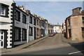
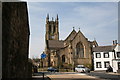
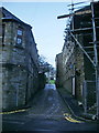
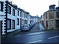
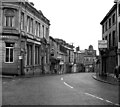
Photos of BB12 8DN
Area Information
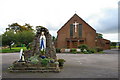
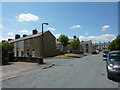
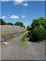
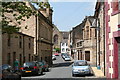
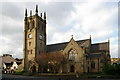
Living in BB12 8DN means being part of a compact, historically rich postcode area within the civil parish of Padiham, Lancashire. This small residential cluster sits on the River Calder, just 3 miles west of Burnley and near Pendle Hill, blending rural charm with proximity to urban services. The area’s population of 1,623 is densely packed across 2.7 hectares, creating a tight-knit community with a median age of 47. Much of the area is a conservation zone, preserving its heritage as a former market town that once thrived on trade from Pendleside. Today, the landscape is marked by 19th-century mills, listed buildings like St Leonard’s Parish Church, and the remnants of a once-bustling industrial past. While the area lacks modern commercial hubs, its historical character and nearby transport links offer a balance of tradition and practicality. Residents benefit from proximity to Burnley’s amenities and the natural beauty of the surrounding countryside, making it a choice for those seeking a quiet, rooted lifestyle with access to regional connectivity.
- Area Type
- Postcode
- Area Size
- 2.7 hectares
- Population
- 1623
- Population Density
- 4332 people/km²
The property market in BB12 8DN is defined by its small size and the dominance of houses over flats or apartments. With a home ownership rate of 43%, the area appears to have a modest proportion of owner-occupied homes, suggesting a significant share of rental properties or leaseholds. The predominance of houses indicates a focus on family-friendly housing, though the limited area size may restrict housing stock. Buyers should consider nearby zones for additional options, as the immediate vicinity is constrained. The lack of high-rise or multi-unit developments suggests a quieter, more traditional residential feel. However, the area’s compact nature means property values may be influenced by proximity to key amenities like rail stations and historical sites. For those seeking a home with character, the conservation area status and listed buildings offer unique opportunities, though buyers should weigh this against the area’s limited expansion potential.
House Prices in BB12 8DN
Showing 29 properties
| Address | Type | Beds | Baths | Last Sale Price | Last Sale Date | |
|---|---|---|---|---|---|---|
| 7 Grove Lane, Padiham, BB12 8DN | house | 1 | 1 | £44,000 | Mar 2025 | |
| 33 Grove Lane, Padiham, BB12 8DN | Terraced | 3 | 1 | £110,000 | Nov 2024 | |
| Former, 25A Grove Lane, Padiham, BB12 8DN | Detached | - | - | £98,000 | Oct 2022 | |
| 25 Grove Lane, Padiham, BB12 8DN | house | - | - | £98,000 | Oct 2022 | |
| 9 Grove Lane, Padiham, BB12 8DN | Terraced | 2 | 1 | £87,500 | Dec 2020 | |
| 47 Grove Lane, Padiham, BB12 8DN | house | - | - | £70,000 | Mar 2019 | |
| 3 Grove Lane, Padiham, BB12 8DN | Terraced | 4 | 1 | £100,000 | Apr 2016 | |
| 1 Grove Lane, Padiham, BB12 8DN | Terraced | 5 | 2 | £120,000 | Nov 2015 | |
| 15 Grove Lane, Padiham, BB12 8DN | Terraced | 2 | 1 | £75,000 | May 2014 | |
| 43 Grove Lane, Padiham, BB12 8DN | house | - | - | £89,950 | Oct 2012 |
Energy Efficiency in BB12 8DN
Residents of BB12 8DN have access to essential retail and dining options within practical reach, including Lidl Padiham, Tesco Padiham, and Spar, ensuring daily necessities are easily obtainable. The area’s proximity to rail stations like Hapton and Burnley Barracks connects it to regional services and cultural hubs. Historically, Padiham’s market town roots are reflected in its conservation area status, with landmarks such as St Leonard’s Parish Church and the preserved Victoria Mill offering a blend of heritage and leisure. Nearby, the National Trust’s Gawthorpe Hall provides additional cultural and recreational opportunities. The River Calder and surrounding countryside offer walking and outdoor pursuits, while the nearby canal network hints at potential for waterside activities. Though the area lacks large-scale commercial centres, its compact design ensures amenities are closely clustered, supporting a lifestyle that values convenience, history, and natural surroundings.
Amenities
Schools
| Rank | School | Type | Entry gender | Ages |
|---|
Explore more schools in this area
Go to Schools tabDemographics
The community in BB12 8DN is predominantly composed of adults aged 30–64, reflecting a median age of 47. Home ownership stands at 43%, indicating a mix of owner-occupied and rental properties, though the exact proportion of renters is not specified. The area’s accommodation is largely houses, aligning with its residential character. The predominant ethnic group is White, though no further breakdown of diversity is provided. With a population density of 59,477 people per square kilometre, the area is highly compact, which may influence the availability of private outdoor space. This density also means services and amenities are closely clustered, though the lack of detailed deprivation data means it is unclear how economic challenges might affect daily life. The demographic profile suggests a stable, middle-aged population, likely drawn to the area for its historical assets and proximity to Burnley’s infrastructure.
Household Size
Accommodation Type
Tenure
Ethnic Group
Religion
Household Composition
Age
Household Deprivation
NS-SEC
Explore more demographic insights in this area
Go to Demographics tabPlanning
Planning Constraints
- Flood RiskPremium
- Ramsar Wetland SitesPremium
- Area of Outstanding Natural BeautyPremium
- Protected Nature ReservePremium
- Protected WoodlandPremium