Area Overview for BB12 7QW
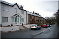
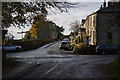
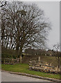
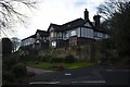
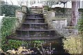
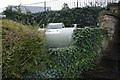
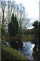
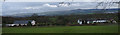
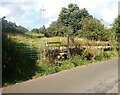
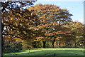
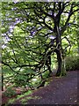
Photos of BB12 7QW

Area Information
Living in BB12 7QW means being part of a small, residential cluster in Ribble Valley, Lancashire, with a population of 1,417 spread across 15.1 hectares. This area, known as Simonstone, is a village with a long history, including land ownership by the Cockshutt family from the 1500s. Its compact size fosters a close-knit community, where daily life is shaped by proximity to local amenities and historical sites. The area’s charm lies in its quiet, rural character, with 22 listed buildings and connections to Gawthorpe Hall, a historic pele tower. Residents benefit from a low population density of 250 people per square kilometre, offering a sense of space without urban congestion. While small, BB12 7QW is well-connected to nearby towns via rail, with stations like Hapton and Whalley within reach. Its blend of heritage and practicality makes it appealing to those seeking a balanced lifestyle.
- Area Type
- Postcode
- Area Size
- 15.1 hectares
- Population
- 1417
- Population Density
- 250 people/km²
The property market in BB12 7QW is dominated by owner-occupied homes, with 78% of residents owning their properties. Houses are the primary accommodation type, which is typical for rural and semi-rural areas. This suggests a market where long-term residency is common, and properties are likely to be family homes rather than short-term rentals. The small area size of 15.1 hectares means the housing stock is limited, so buyers may need to consider nearby areas for more options. The absence of rental market data implies a focus on homeownership, which can be advantageous for those seeking stability but may limit availability for renters.
House Prices in BB12 7QW
Showing 7 properties
| Address | Type | Beds | Baths | Last Sale Price | Last Sale Date | |
|---|---|---|---|---|---|---|
| Coppice View Cottage, Trapp Lane, Simonstone, BB12 7QW | house | - | - | £250,000 | Nov 2024 | |
| The Old Stables, Trapp Lane, Simonstone, BB12 7QW | Terraced | 2 | 1 | £150,000 | Aug 2020 | |
| Higher Trapp Barn, Trapp Lane, Simonstone, BB12 7QW | Terraced | 4 | 2 | £367,500 | Jul 2020 | |
| The Shippon, Trapp Lane, Simonstone, BB12 7QW | Cottage | 3 | 2 | £180,000 | Jun 2015 | |
| Higher Trapp House, Trapp Lane, Simonstone, BB12 7QW | Cottage | 2 | 1 | £197,500 | Sep 2003 | |
| Hill House, Trapp Lane, Simonstone, BB12 7QW | Bungalow | - | - | - | - | |
| Studio, Trapp Forge Ltd, Trapp Lane, Simonstone, BB12 7QW | Industrial | - | - | - | - |
Energy Efficiency in BB12 7QW
Residents of BB12 7QW enjoy a mix of retail and transport amenities within practical reach. Local shops include Spar, Lidl Padiham, and Tesco Padiham, offering everyday essentials and groceries. These stores cater to daily needs without requiring long trips. The area’s proximity to rail stations like Hapton and Whalley enhances mobility, linking residents to broader networks for work, shopping, or leisure. While the data does not mention parks or leisure facilities, the historical and listed buildings in Simonstone suggest cultural and heritage sites may be accessible nearby. The combination of retail options and rail connectivity supports a lifestyle that balances convenience with rural tranquillity.
Amenities
Schools
Residents of BB12 7QW have access to two primary schools with good Ofsted ratings: Read St John’s CofE Primary School and Simonstone St Peter’s Church of England Primary School. Both institutions provide quality education for younger children, ensuring families have reliable options for early schooling. The presence of two primary schools within the area reduces the need for long commutes, which is particularly beneficial for parents. The good ratings indicate that these schools meet or exceed national standards in teaching and pupil outcomes. For families prioritising education, this dual-school setup offers flexibility and convenience, reinforcing the area’s appeal as a place to raise children.
| Rank | School | Type | Entry gender | Ages |
|---|
Explore more schools in this area
Go to Schools tabDemographics
The community in BB12 7QW is predominantly composed of adults aged 30–64, with a median age of 47. This suggests a stable population with strong ties to the area. Home ownership is high, at 78%, with houses being the primary accommodation type. The predominant ethnic group is White, reflecting the area’s historical and cultural continuity. The low population density of 250 people per square kilometre indicates a spread-out, less crowded environment. While no specific deprivation data is provided, the high home ownership rate and age profile suggest a community focused on long-term residency rather than transient populations. This demographic structure likely supports local services and amenities tailored to family and middle-aged residents.
Household Size
Accommodation Type
Tenure
Ethnic Group
Religion
Household Composition
Age
Household Deprivation
NS-SEC
Explore more demographic insights in this area
Go to Demographics tabPlanning
Planning Constraints
- Flood RiskPremium
- Ramsar Wetland SitesPremium
- Area of Outstanding Natural BeautyPremium
- Protected Nature ReservePremium
- Protected WoodlandPremium