Area Overview for BB12 7QS
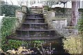
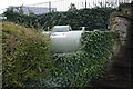
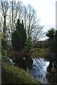
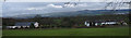
Photos of BB12 7QS

Area Information
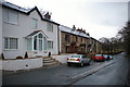
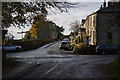
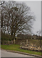
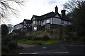
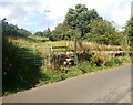
Living in BB12 7QS means residing within Simonstone, a civil parish in Ribble Valley, Lancashire. This small residential cluster covers an area of 9,610 square metres and houses a population of 1,417 residents. The community is defined by its compact footprint and historic character, situated at coordinates 53.796717, -2.3413. Daily life here revolves around a quiet, village atmosphere where the past remains distinctly visible. You will find yourself walking past 22 listed buildings, including remnants associated with Gawthorpe Hall, which has origins stretching back to a pele tower fortification. The area reflects a deep-rooted local heritage, with title records from the Shuttleworth Estate showing the Cockshutt family held land there since 1562. Historical records indicate a prosperous local history, with John Cockshot assessed on eight hearths in 1666. For a prospective buyer, Simonstone offers a break from the pace of larger urban centres. It is a place where the dominant image is one of established stone cottages and manicured grounds rather than high-density housing blocks. The proximity to Hapton, Huncoat, and Whalley railway stations provides access beyond the immediate parish, while the immediate surroundings remain low-density and peaceful. Buyers here are purchasing a slice of Lancashire history where development is naturally constrained by the presence of protected heritage assets and a clear, manageable village boundary.
- Area Type
- Postcode
- Area Size
- 9610 m²
- Population
- 1417
- Population Density
- 250 people/km²
The property market in BB12 7QS is almost entirely comprised of houses, excluding the rare flat or maisonette. With 78 per cent of residents owning their homes, the area functions as a classic owner-occupied market rather than a rental hub. This statistic indicates that the vast majority of properties are sold as second homes, family residences, or retirement properties. When looking for homes in BB12 7QS, you will encounter a stock defined by traditional construction rather than modern developments bought for short-term letting. Because the majority of occupants own their property, supply is often determined by family inheritance or sell-down patterns rather than new builds entering the market. This creates a niche market where prices reflect the specific historical value of each house, especially given the presence of 22 listed buildings within the parish. You are competing for existing stock where the character of the home often dictates the price more than the location itself, although the quiet nature of Simonstone adds value. If you are seeking a rental property, the options are very limited. The market reflects a desire for permanence, meaning you buy into a community where residents have deep roots and there is little turnover.
House Prices in BB12 7QS
Showing 9 properties
| Address | Type | Beds | Baths | Last Sale Price | Last Sale Date | |
|---|---|---|---|---|---|---|
| 2, Wicken Tree Row, Whins Lane, Simonstone, BB12 7QS | house | - | - | £185,000 | Jan 2021 | |
| 4, Wicken Tree Row, Whins Lane, Simonstone, BB12 7QS | house | - | - | £185,000 | Jun 2006 | |
| 5, Wicken Tree Row, Whins Lane, Simonstone, BB12 7QS | house | - | - | £135,000 | May 2003 | |
| 6, Wicken Tree Row, Whins Lane, Simonstone, BB12 7QS | house | - | - | £127,000 | Oct 2002 | |
| 3, Wicken Tree Row, Whins Lane, Simonstone, BB12 7QS | Terraced | - | - | - | - | |
| 7, Wicken Tree Row, Whins Lane, Simonstone, BB12 7QS | Terraced | - | - | - | - | |
| 7, Annexe, Wicken Tree Row, Whins Lane, Simonstone, BB12 7QS | Flat | - | - | - | - | |
| 1, Wicken Tree Row, Whins Lane, Simonstone, BB12 7QS | Terraced | - | - | - | - | |
| Whins Cottage, Whins Lane, Simonstone, BB12 7QS | Terraced | - | - | - | - |
Energy Efficiency in BB12 7QS
Your lifestyle in BB12 7QS is anchored by immediate access to key amenities within a short drive. Retail options are well-covered with five shops nearby, including Spar, Lidl Padiham, and Tesco Padiham. These supermarkets and convenience stores ensure you can find everyday groceries and essentials without traveling far. For rail travel, the same five stations accessible to residents serve as your gateway to the wider North West, offering connections via Hapton, Huncoat, and Whalley. Living here offers a blend of self-sufficiency and regional access. You will find that daily shopping is convenient due to the presence of established retailers like Tesco and Lidl in Padiham. The area is not defined by a nightlife scene but by the reliability of getting goods and services delivered to your door or localised via these specific chains. There are no parks or leisure centres listed as immediate amenities, so your outdoor recreation relies on the natural surroundings of the Ribble Valley. The lifestyle is one of quiet practicality. You rely on the robust connection to Padiham for major errands and use the railway network for longer journeys. This setup suits those who prefer doing their own shopping at familiar local chains rather than browsing smaller independent outlets.
Amenities
Schools
Families considering homes in BB12 7QS have access to two specific primary schools in close proximity. Read St John's CofE Primary School is a primary institution with a Ofsted rating of good. Nearby, Simonstone St Peter's Church of England Primary School also holds a good Ofsted rating. Both schools serve the local community and offer education within the Christian ethos of the Church of England. This mix provides a consistent educational environment for children living in the parish. The availability of two nearby options means that parents do not face long commutes to reach their child's education. Both facilities are classified as primary schools, meaning this specific postcode cluster serves mainly the under-11 age group. While secondary education stations are not listed in the immediate vicinity data, the presence of these two good-rated primaries ensures that younger children have access to stable schooling without needing to travel to larger towns. For those moving specifically for education, the rating of both schools provides a reliable baseline for quality assurance. The Ofsted judgments confirm that these institutions meet the required standards for safety and educational achievement in a rural setting.
| Rank | School | Type | Entry gender | Ages |
|---|
Explore more schools in this area
Go to Schools tabDemographics
The community in BB12 7QS is dominated by adults, with the age of 47 marking the median for residents. The most common age range consists of adults between 30 and 64 years old, indicating a population composed largely of families and established households rather than students or empty nesters. In terms of living arrangements, you will find that 78 per cent of residents own their homes. This high rate of ownership suggests a community where people have settled for the long term, often inheriting family estates or purchasing property as a permanent home. The predominant ethnicity in the area is White, reflecting the traditional demographic profile of rural Lancashire. As the primary accommodation type, houses make up the vast majority of the residential stock, meaning you are unlikely to see apartment blocks or flat conversions. This focus on detached or semi-detached properties aligns with the preference of the adult population for spacious living. The lack of significant population density, at 250 people per square kilometre, ensures that you experience fewer constraints on private space and garden usage. There are no indicators of high deprivation affecting the quality of life here. Instead, the demographic data points to a stable, owner-occupied neighbourhood where residents are familiar with the local landscape and have invested in their homes over decades.
Household Size
Accommodation Type
Tenure
Ethnic Group
Religion
Household Composition
Age
Household Deprivation
NS-SEC
Explore more demographic insights in this area
Go to Demographics tabPlanning
Planning Constraints
- Flood RiskPremium
- Ramsar Wetland SitesPremium
- Area of Outstanding Natural BeautyPremium
- Protected Nature ReservePremium
- Protected WoodlandPremium