Area Overview for BB12 7PL
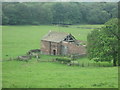
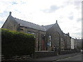
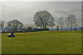
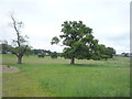
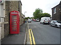
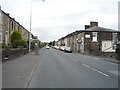
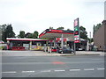
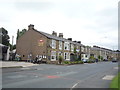
Photos of BB12 7PL
Area Information
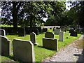
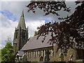
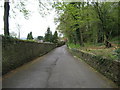
Living in BB12 7PL offers a quiet, compact residential experience in the Ribble Valley district of Lancashire. The area, covering 4,659 square metres, is home to 1,237 people, creating a low-density, community-focused environment. Situated along the A671, it lies within a historical township that developed along medieval roads connecting Whalley and Padiham. The village retains a village character, with stone-quarried homes and small businesses. Its proximity to natural landmarks like Pendle Hill and the Trough of Bowland, along with nearby attractions such as Clitheroe’s Norman castle and Gawthorpe Hall, offers residents a blend of rural tranquillity and accessible cultural amenities. With a population density of 249 people per square kilometre, the area feels intimate, where local landmarks like Read Hall and St John Evangelist church anchor its heritage. Daily life here is shaped by small-scale commerce, historic sites, and easy access to regional towns, making it appealing to those seeking a slower pace without complete isolation from urban conveniences.
- Area Type
- Postcode
- Area Size
- 4659 m²
- Population
- 1237
- Population Density
- 249 people/km²
The property market in BB12 7PL is dominated by owner-occupied homes, with 93% of properties in private hands. This high level of home ownership suggests a stable, long-term community with limited rental activity. The accommodation type is predominantly houses, reflecting the area’s rural and semi-rural character. Given the small population of 1,237 and the area’s size, the housing stock is likely limited, making properties here relatively scarce. Buyers should consider the proximity to nearby towns like Padiham and Whalley, which may offer additional options for those seeking more variety. The focus on owner-occupied homes indicates a market where properties are likely to hold value, though the small size of the area means competition for available listings could be keen. For those prioritising a quiet, established community with historic charm, BB12 7PL’s housing stock offers a distinct, characterful alternative to larger urban centres.
House Prices in BB12 7PL
Showing 7 properties
| Address | Type | Beds | Baths | Last Sale Price | Last Sale Date | |
|---|---|---|---|---|---|---|
| 2 Masterson Avenue, Read, BB12 7PL | Detached | 3 | - | £225,000 | Sep 2013 | |
| 1 Masterson Avenue, Read, BB12 7PL | Detached | - | - | £104,000 | May 1997 | |
| 6 Masterson Avenue, Read, BB12 7PL | Detached | - | - | - | - | |
| 5 Masterson Avenue, Read, BB12 7PL | Bungalow | - | - | - | - | |
| 8 Masterson Avenue, Read, BB12 7PL | Bungalow | - | - | - | - | |
| 3 Masterson Avenue, Read, BB12 7PL | Bungalow | - | - | - | - | |
| 4 Masterson Avenue, Read, BB12 7PL | Detached | - | - | - | - |
Energy Efficiency in BB12 7PL
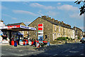
Residents of BB12 7PL have access to essential retail amenities within practical reach, including Spar, Lidl Padiham, and Tesco Padiham, ensuring daily shopping needs are met. The area’s rail network, with stations at Hapton, Huncoat, and Whalley, provides connections to nearby towns and services. While the data does not list parks or leisure facilities directly, the village’s historical context and proximity to natural landmarks like Spring Wood and Pendle Hill suggest opportunities for outdoor activities. The presence of small businesses and stone-quarried homes contributes to a distinct, localised character. For those valuing convenience, the combination of nearby shops, rail links, and proximity to regional attractions like Clitheroe and Gawthorpe Hall creates a lifestyle that balances rural tranquillity with accessible amenities.
Amenities
Schools
| Rank | School | Type | Entry gender | Ages |
|---|
Explore more schools in this area
Go to Schools tabDemographics
The population of BB12 7PL is predominantly middle-aged, with a median age of 47 and most residents falling within the 30–64 age range. Over 93% of homes are owner-occupied, reflecting a stable, long-term community. The area is characterised by a high proportion of houses rather than flats, aligning with its rural setting. The predominant ethnic group is White, with no specific data provided on other demographics. The low population density of 249 people per square kilometre suggests a spread-out, less congested living environment. While the data does not include deprivation metrics, the high home ownership rate and age profile indicate a mature, settled population with established roots. This demographic profile suggests a community focused on stability, with limited turnover of residents, which can be advantageous for those seeking a consistent, neighbourly atmosphere.
Household Size
Accommodation Type
Tenure
Ethnic Group
Religion
Household Composition
Age
Household Deprivation
NS-SEC
Explore more demographic insights in this area
Go to Demographics tabPlanning
Planning Constraints
- Flood RiskPremium
- Ramsar Wetland SitesPremium
- Area of Outstanding Natural BeautyPremium
- Protected Nature ReservePremium
- Protected WoodlandPremium