Area Overview for BB12 7QQ
Photos of BB12 7QQ
Area Information
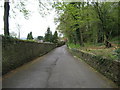
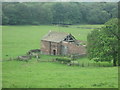
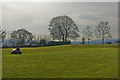
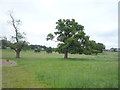
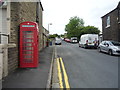
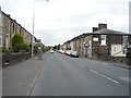
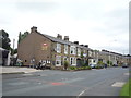
BB12 7QQ is a small, tightly knit residential cluster in England’s Lancashire county, nestled within the Ribble Valley district. Covering 4,662 square metres, this area is home to 1,237 residents, with a population density of 249 people per square kilometre. Its character is shaped by historical roots; it lies along the A671 road, once a 19th-century turnpike, and is part of a civil parish that developed along medieval routes connecting Whalley and Padiham. The area’s charm lies in its blend of rural tranquillity and proximity to nearby towns like Clitheroe, offering access to cultural and commercial hubs. With a median age of 47, the community is predominantly composed of adults aged 30–64, reflecting a mature, stable population. Over 90% of residents own their homes, many of which are traditional houses, creating a sense of permanence. The area’s low crime risk and absence of environmental constraints make it appealing for those seeking a peaceful, secure place to live without sacrificing connectivity to essential services.
- Area Type
- Postcode
- Area Size
- 4662 m²
- Population
- 1237
- Population Density
- 249 people/km²
The property market in BB12 7QQ is characterised by high home ownership (93%) and a predominance of houses over flats, reflecting a traditional, family-oriented housing stock. This suggests a market skewed towards owner-occupation rather than rental, with limited availability of newer or smaller properties. The small area size—just 4,662 square metres—means the immediate surroundings have limited housing stock, which could make the market competitive for buyers. However, the absence of planning constraints like protected woodlands or Areas of Outstanding Natural Beauty may offer flexibility for future development. For buyers, this means a focus on existing homes, many of which are likely to be older, characterful properties. The area’s stability, combined with its low crime risk and proximity to rail links, makes it an attractive option for those seeking a secure, established home in a rural setting.
House Prices in BB12 7QQ
Showing 6 properties
| Address | Type | Beds | Baths | Last Sale Price | Last Sale Date | |
|---|---|---|---|---|---|---|
| 2 Patrick Avenue, Read, BB12 7QQ | Detached | 4 | 2 | £270,000 | Jul 2015 | |
| 4 Patrick Avenue, Read, BB12 7QQ | Detached | - | - | £325,000 | Jul 2007 | |
| 6 Patrick Avenue, Read, BB12 7QQ | Detached | - | - | - | - | |
| 3 Patrick Avenue, Read, BB12 7QQ | Detached | - | - | - | - | |
| 5 Patrick Avenue, Read, BB12 7QQ | Detached | - | - | - | - | |
| 1 Patrick Avenue, Read, BB12 7QQ | Detached | - | - | - | - |
Energy Efficiency in BB12 7QQ
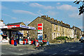
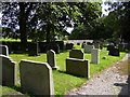
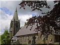
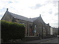
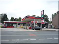
Living in BB12 7QQ offers a blend of convenience and rural charm. Nearby, residents have access to essential retail outlets such as Spar, Lidl Padiham, and Tesco Padiham, ensuring daily needs are met without long journeys. The area’s historical and cultural richness is evident in landmarks like Read Hall, a historic seat of the Nowell family, and St John Evangelist parish church, built in 1884. Natural attractions such as Spring Wood and Whalley Abbey provide opportunities for walking and relaxation, while proximity to Pendle Hill and the Trough of Bowland offers scenic routes. The presence of small businesses and traditional stone-built homes adds to the area’s character, creating a lifestyle that balances practicality with heritage.
Amenities
Schools
| Rank | School | Type | Entry gender | Ages |
|---|
Explore more schools in this area
Go to Schools tabDemographics
The population of BB12 7QQ is predominantly adults aged 30–64, with a median age of 47. This suggests a community of established professionals and families, many of whom have lived in the area for years. Home ownership is exceptionally high at 93%, with most properties being houses rather than flats, indicating a preference for traditional, larger homes. The predominant ethnic group is White, reflecting the area’s historical and cultural continuity. With a population density of 249 people per square kilometre, the area is neither overcrowded nor sparse, offering a balance between seclusion and proximity to amenities. The absence of specific deprivation data means the quality of life here is inferred from the low crime risk and stable demographics, suggesting a community with strong social cohesion and limited socioeconomic disparity.
Household Size
Accommodation Type
Tenure
Ethnic Group
Religion
Household Composition
Age
Household Deprivation
NS-SEC
Explore more demographic insights in this area
Go to Demographics tabPlanning
Planning Constraints
- Flood RiskPremium
- Ramsar Wetland SitesPremium
- Area of Outstanding Natural BeautyPremium
- Protected Nature ReservePremium
- Protected WoodlandPremium