Area Overview for BB12 6PQ
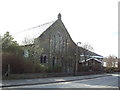
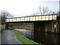
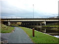
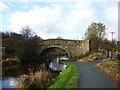
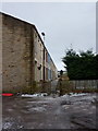
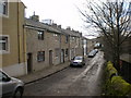
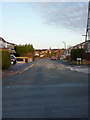
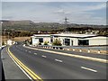
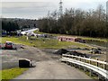
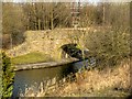
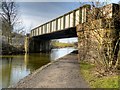
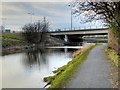
Photos of BB12 6PQ
Area Information
Living in BB12 6PQ means being part of a compact, densely populated residential cluster in the Borough of Burnley, Lancashire. The area covers just 6,265 square metres, housing 1,729 residents in a space where population density reaches 275,981 people per square kilometre. This small postcode area lies within Rosegrove with Lowerhouse Ward, historically part of the manor of Ightenhill. The landscape is shaped by its industrial past, with historic mill buildings like Empire Mill and Imperial Mill on Liverpool Road now repurposed as retail, office, and residential spaces. Daily life here balances proximity to Burnley’s town centre with a quiet, residential feel. The area’s character is defined by its compact nature, where amenities and transport links are within practical reach, and the community is largely composed of homeowners in mid-to-late adulthood. For those seeking a blend of historical architecture and modern convenience, BB12 6PQ offers a distinct slice of North West England’s urban fabric.
- Area Type
- Postcode
- Area Size
- 6265 m²
- Population
- 1729
- Population Density
- 3109 people/km²
The property market in BB12 6PQ is characterised by a high rate of home ownership (78%), with houses making up the predominant accommodation type. This suggests a market skewed towards owner-occupation rather than rentals, likely due to the area’s compact size and historical housing stock. The presence of converted industrial buildings, such as the former Empire Mill and Imperial Mill, adds a unique dimension to the housing stock, offering potential for character homes with historical features. However, the small area size means the market is limited to a handful of properties, which could lead to competition among buyers. For those seeking a home here, the focus is on older, established properties rather than new developments. The high ownership rate also indicates a community with long-term residency, which may influence property values and desirability.
House Prices in BB12 6PQ
Showing 18 properties
| Address | Type | Beds | Baths | Last Sale Price | Last Sale Date | |
|---|---|---|---|---|---|---|
| 9 Riverside Mews, Burnley, BB12 6PQ | Flat | 2 | - | £111,500 | Dec 2024 | |
| 19 Riverside Mews, Burnley, BB12 6PQ | Flat | - | - | £115,000 | Mar 2024 | |
| 3 Riverside Mews, Burnley, BB12 6PQ | Flat | - | - | £110,000 | Feb 2024 | |
| 2 Riverside Mews, Burnley, BB12 6PQ | Flat | - | - | £118,000 | Dec 2023 | |
| 14 Riverside Mews, Burnley, BB12 6PQ | Flat | - | - | £105,000 | Oct 2023 | |
| 10 Riverside Mews, Burnley, BB12 6PQ | Flat | - | - | £117,000 | Mar 2023 | |
| 5 Riverside Mews, Burnley, BB12 6PQ | Flat | 1 | 1 | £105,000 | Nov 2022 | |
| 16 Riverside Mews, Burnley, BB12 6PQ | Flat | - | - | £107,000 | Apr 2019 | |
| 8 Riverside Mews, Burnley, BB12 6PQ | Maisonette | - | - | £110,000 | Mar 2008 | |
| 12 Riverside Mews, Burnley, BB12 6PQ | Flat | 2 | 1 | £114,950 | Jan 2006 |
Energy Efficiency in BB12 6PQ
The lifestyle in BB12 6PQ is shaped by its proximity to essential amenities. Retail options include Spar, Tesco Padiham, and Lidl Padiham, offering everyday shopping needs within walking or short driving distance. The area’s rail connections to Rose Grove, Hapton, and Burnley Barracks provide access to Burnley’s town centre, where additional services and leisure opportunities are available. Historically, the district’s industrial heritage is evident in repurposed sites like Empire Mill and Imperial Mill, now serving as retail and office spaces. While the area lacks large parks or leisure facilities, its compact nature means residents can reach Burnley’s broader amenities quickly. The mix of local shops and transport links creates a convenient, self-contained lifestyle, ideal for those prioritising accessibility over expansive recreational spaces.
Amenities
Schools
| Rank | School | Type | Entry gender | Ages |
|---|
Explore more schools in this area
Go to Schools tabDemographics
The population of BB12 6PQ is predominantly adults aged 30–64, with a median age of 47. This suggests a community rooted in stability, where many residents are likely in their peak working years or nearing retirement. Home ownership is high at 78%, indicating a strong presence of long-term residents. The accommodation type is primarily houses, reflecting a more traditional housing stock compared to high-density flats. The predominant ethnic group is White, though no specific diversity data is provided. The age profile and ownership rates imply a mature, settled population with established roots. While no deprivation figures are available, the high home ownership and age range suggest a community with relatively stable economic conditions. However, the area’s density and historical industrial legacy may influence local challenges, such as infrastructure pressures or housing stock age.
Household Size
Accommodation Type
Tenure
Ethnic Group
Religion
Household Composition
Age
Household Deprivation
NS-SEC
Explore more demographic insights in this area
Go to Demographics tabPlanning
Planning Constraints
- Flood RiskPremium
- Ramsar Wetland SitesPremium
- Area of Outstanding Natural BeautyPremium
- Protected Nature ReservePremium
- Protected WoodlandPremium