Area Overview for BB12 6PG
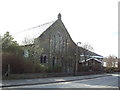
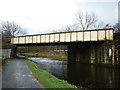
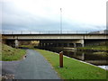
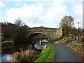
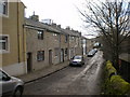
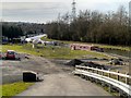
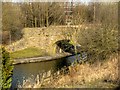
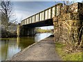
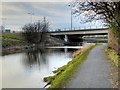
Photos of BB12 6PG
Area Information
Living in BB12 6PG means inhabiting a compact, densely populated residential cluster within the Borough of Burnley, Lancashire. The area spans just 2.5 hectares, housing 1,729 people in a population density of 70,393 per square kilometre — a testament to its small-scale, tightly knit character. Historically linked to the manor of Ightenhill, this postcode is part of the Rosegrove with Lowerhouse Ward, a district with industrial roots. Notable landmarks like Empire Mill and Imperial Mill, once central to Burnley’s textile industry, now stand as converted retail, office, and residential spaces. Daily life here is shaped by proximity to Burnley’s urban core, with nearby rail stations and local shops providing practical connectivity. The area’s demographic profile — predominantly adults aged 30–64, with 78% owning their homes — suggests a stable, established community. While the density feels intimate, the absence of major green spaces or protected natural areas means residents rely on nearby Burnley for broader recreational opportunities. BB12 6PG is a microcosm of a town’s evolving identity, balancing historical legacy with modern living.
- Area Type
- Postcode
- Area Size
- 2.5 hectares
- Population
- 1729
- Population Density
- 3109 people/km²
The property market in BB12 6PG is characterised by high home ownership (78%) and a predominance of houses. This suggests a market skewed towards owner-occupied properties rather than rentals, which is typical of smaller, established communities. The concentration of houses indicates a mix of semi-detached and detached homes, likely reflecting the area’s residential density and historical development patterns. Given the postcode’s small size (2.5 hectares), the housing stock is limited, meaning buyers may need to consider nearby areas for more options. The high proportion of owner-occupied properties also implies a stable market with lower turnover, potentially offering long-term value retention. However, the lack of specific data on property prices or recent sales means the market’s current dynamics remain opaque. For buyers, this area’s compact nature means proximity to Burnley’s amenities is a key factor, with transport links playing a critical role in accessibility.
House Prices in BB12 6PG
Showing 53 properties
| Address | Type | Beds | Baths | Last Sale Price | Last Sale Date | |
|---|---|---|---|---|---|---|
| 18 Printers Fold, Burnley, BB12 6PG | Semi-detached | 3 | 1 | £120,000 | May 2025 | |
| 6 Printers Fold, Burnley, BB12 6PG | house | 3 | - | £150,000 | Mar 2025 | |
| 10A Printers Fold, Burnley, BB12 6PG | Semi-detached | 3 | 2 | £160,000 | Feb 2025 | |
| 20 Printers Fold, Burnley, BB12 6PG | Bungalow | 2 | 1 | £190,000 | Aug 2024 | |
| 74 Printers Fold, Burnley, BB12 6PG | Semi-detached | 4 | 1 | £210,000 | Jun 2022 | |
| 38 Printers Fold, Burnley, BB12 6PG | Retail | 3 | - | £162,500 | Apr 2022 | |
| 70 Printers Fold, Burnley, BB12 6PG | Semi-detached | 3 | 1 | £162,500 | Mar 2022 | |
| 76 Printers Fold, Burnley, BB12 6PG | Semi-detached | 3 | 1 | £141,000 | Jun 2021 | |
| 36 Printers Fold, Burnley, BB12 6PG | house | 3 | 1 | £145,000 | May 2021 | |
| 90 Printers Fold, Burnley, BB12 6PG | Detached | 4 | 2 | £215,000 | Apr 2021 |
Energy Efficiency in BB12 6PG
Residents of BB12 6PG have access to essential retail and transport hubs within walking or short driving distance. The area’s proximity to Spar, Tesco Padiham, and Lidl Padiham ensures daily shopping needs are met without venturing far. Rail stations like Rose Grove and Hapton provide direct links to Burnley’s town centre and regional destinations, enhancing connectivity for work, leisure, and socialising. While the postcode itself lacks major parks or green spaces, the nearby historic sites such as Empire Mill and Imperial Mill add character to the area, offering potential for heritage walks or cultural interest. The compact nature of BB12 6PG means amenities are concentrated, fostering a sense of convenience. However, the absence of dedicated leisure facilities or recreational spaces within the postcode means residents may need to travel to Burnley for activities like gyms, cinemas, or larger retail outlets. The blend of practicality and historical context creates a lifestyle that balances local convenience with the broader offerings of the surrounding town.
Amenities
Schools
| Rank | School | Type | Entry gender | Ages |
|---|
Explore more schools in this area
Go to Schools tabDemographics
The population of BB12 6PG is predominantly adults aged 30–64, with a median age of 47. This suggests a mature, settled community, likely with strong family ties and long-term residency. Home ownership is high at 78%, reflecting a preference for stable, long-term housing over rental properties. The accommodation type is primarily houses, indicating a mix of semi-detached and detached homes typical of smaller towns. The predominant ethnic group is White, with no specific data on diversity or deprivation levels provided. The age profile and home ownership rates imply a community focused on maintaining property value and local stability. However, the lack of detailed information on income distribution or social deprivation means the area’s quality of life cannot be fully assessed from this data alone. The high proportion of owner-occupied homes also suggests a lower turnover of residents, contributing to a sense of continuity in the neighbourhood.
Household Size
Accommodation Type
Tenure
Ethnic Group
Religion
Household Composition
Age
Household Deprivation
NS-SEC
Explore more demographic insights in this area
Go to Demographics tabPlanning
Planning Constraints
- Flood RiskPremium
- Ramsar Wetland SitesPremium
- Area of Outstanding Natural BeautyPremium
- Protected Nature ReservePremium
- Protected WoodlandPremium