Area Overview for BB12 6ND
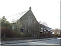
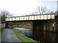
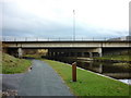
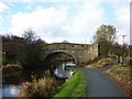
Photos of BB12 6ND
Area Information
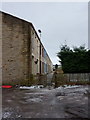
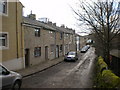
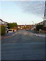
BB12 6ND is a small residential cluster nestled within the Borough of Burnley in Lancashire, a historic town with roots in the manor of Ightenhill. The area has a population of 1,729, reflecting its compact nature. Residents here live in a mix of traditional housing stock, with a focus on owner-occupied homes. The ward includes parts of Rosegrove with Lowerhouse, a district marked by its industrial heritage, such as the now-retired Empire Mill and Imperial Mill on Liverpool Road. These historic sites, though no longer industrial, contribute to the area’s character. Daily life in BB12 6ND is shaped by its proximity to Burnley’s urban core, offering access to local amenities while retaining a quieter, residential feel. The area’s small size means it is tightly knit, with a population skewed toward adults aged 30–64, suggesting a community of long-term residents and families.
- Area Type
- Postcode
- Area Size
- Not available
- Population
- 1729
- Population Density
- 3109 people/km²
The property market in BB12 6ND is dominated by owner-occupied homes, with 78% of properties owned by residents rather than rented. This suggests a stable market with limited turnover, as the area is not heavily reliant on rental demand. The accommodation type is predominantly houses, which is typical of smaller, residential postcode areas in England. This housing stock likely appeals to families and individuals seeking traditional, long-term homes. Given the area’s compact size and the prevalence of owner-occupation, property prices may be influenced by local demand rather than broader regional trends. Buyers should consider the limited number of properties available, as the small population and housing stock mean opportunities for purchase are constrained to a narrow geographic and demographic scope.
House Prices in BB12 6ND
Showing 2 properties
| Address | Type | Beds | Baths | Last Sale Price | Last Sale Date | |
|---|---|---|---|---|---|---|
| Burnley Windows Ltd, Unit 1 Upper Ground Floor, Greenbrook Works, Lowerhouse Lane, Burnley, BB12 6ND | Office | - | - | - | - | |
| Vacant Offices Upper Ground Floor, Greenbrook Works, Lowerhouse Lane, Burnley, BB12 6ND | Office | - | - | - | - |
Energy Efficiency in BB12 6ND
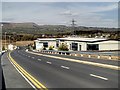
The lifestyle in BB12 6ND is shaped by its proximity to Burnley’s amenities and the availability of essential services. Residents have access to five railway stations, including Rose Grove and Hapton, providing easy links to employment hubs and leisure destinations. For shopping, the area is served by Spar, Tesco Padiham, and Lidl Padiham, offering everyday essentials within a short walk or drive. While the data does not mention parks or recreational facilities, the presence of historic sites like Empire Mill and Imperial Mill adds cultural value to the area. The mix of residential housing and former industrial sites suggests a blend of traditional charm and practical convenience, ideal for those seeking a balance between community and accessibility.
Amenities
Schools
| Rank | School | Type | Entry gender | Ages |
|---|
Explore more schools in this area
Go to Schools tabDemographics
The demographic profile of BB12 6ND is defined by a median age of 47, with the majority of residents falling within the 30–64 age range. This suggests a stable, mature population, likely with established careers and families. Home ownership is high, at 78%, indicating a community where property is predominantly owner-occupied rather than rented. The accommodation type is primarily houses, which aligns with the area’s residential character. The predominant ethnic group is White, reflecting the broader demographic trends in Lancashire. While no specific deprivation data is provided, the high home ownership and age profile suggest a community with a moderate to high quality of life, supported by stable employment and long-term residency.
Household Size
Accommodation Type
Tenure
Ethnic Group
Religion
Household Composition
Age
Household Deprivation
NS-SEC
Explore more demographic insights in this area
Go to Demographics tabPlanning
Planning Constraints
- Flood RiskPremium
- Ramsar Wetland SitesPremium
- Area of Outstanding Natural BeautyPremium
- Protected Nature ReservePremium
- Protected WoodlandPremium