Area Overview for TS8 0UW
Photos of TS8 0UW
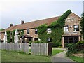
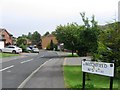
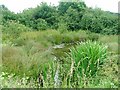
11 photos from this area
Area Information
Key information about the TS8 0UW including its size, population, and administrative classification.
- Area Type
- Postcode
- Area Size
- 2.6 hectares
- Population
- 1678
- Population Density
- 3279 people/km²
House Prices in TS8 0UW
48
Properties
£152,405
Average Sold Price
£45,000
Lowest Price
£327,000
Highest Price
Showing 48 properties
| Address | Type | Beds | Baths | Last Sale Price | Last Sale Date | |
|---|---|---|---|---|---|---|
| 9 Ash Green, Middlesbrough, TS8 0UW | Detached | 3 | 1 | £195,000 | Dec 2024 | |
| 36 Ash Green, Middlesbrough, TS8 0UW | Bungalow | 2 | 1 | £135,000 | Sep 2024 | |
| 37 Ash Green, Middlesbrough, TS8 0UW | Bungalow | 2 | 1 | £116,000 | Dec 2023 | |
| 8 Ash Green, Middlesbrough, TS8 0UW | house | 4 | 2 | £327,000 | Jun 2023 | |
| 46 Ash Green, Middlesbrough, TS8 0UW | Detached | 4 | 2 | £280,000 | Jan 2022 | |
| 44 Ash Green, Middlesbrough, TS8 0UW | house | - | - | £214,000 | Feb 2021 | |
| 26 Ash Green, Middlesbrough, TS8 0UW | Detached | 4 | 2 | £210,000 | Dec 2020 | |
| 29 Ash Green, Middlesbrough, TS8 0UW | Bungalow | - | - | £117,000 | Aug 2019 | |
| 17 Ash Green, Middlesbrough, TS8 0UW | Detached | 4 | 2 | £210,000 | Jun 2019 | |
| 34 Ash Green, Middlesbrough, TS8 0UW | Bungalow | 2 | 1 | £105,000 | Nov 2018 |
Page 1 of 5
Energy Efficiency in TS8 0UW
Amenities
Schools
| Rank | School | Type | Entry gender | Ages |
|---|
Explore more schools in this area
Go to Schools tabDemographics
Household Size
Family (3-5 people)
most common
Accommodation Type
Houses
most common
Tenure
87
majority
Ethnic Group
White
most common
Religion
N/A
most common
Household Composition
N/A
most common
Age
47
median
Adults (30-64 years)
most common
Household Deprivation
N/A
with no deprivation
NS-SEC
38
in Lower managerial occupations
Explore more demographic insights in this area
Go to Demographics tabPlanning
Planning Constraints
- Flood RiskPremium
- Ramsar Wetland SitesPremium
- Area of Outstanding Natural BeautyPremium
- Protected Nature ReservePremium
- Protected WoodlandPremium