Area Overview for TS8 0UP
Photos of TS8 0UP
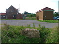
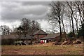
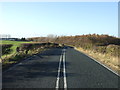
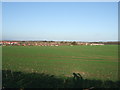
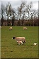
5 photos from this area
Area Information
Key information about the TS8 0UP including its size, population, and administrative classification.
- Area Type
- Postcode
- Area Size
- 1.8 hectares
- Population
- 1678
- Population Density
- 3279 people/km²
House Prices in TS8 0UP
33
Properties
£181,881
Average Sold Price
£72,000
Lowest Price
£310,000
Highest Price
Showing 33 properties
| Address | Type | Beds | Baths | Last Sale Price | Last Sale Date | |
|---|---|---|---|---|---|---|
| 53 Ash Green, Middlesbrough, TS8 0UP | Detached | 4 | 2 | £310,000 | Oct 2025 | |
| 68 Ash Green, Middlesbrough, TS8 0UP | house | 4 | 2 | £260,000 | Aug 2025 | |
| 50 Ash Green, Middlesbrough, TS8 0UP | house | - | - | £240,000 | Dec 2022 | |
| 54 Ash Green, Middlesbrough, TS8 0UP | Detached | 4 | - | £235,000 | Sep 2021 | |
| 57 Ash Green, Middlesbrough, TS8 0UP | Detached | 4 | 1 | £257,000 | Jul 2020 | |
| 79 Ash Green, Middlesbrough, TS8 0UP | Detached | 4 | - | £219,000 | Dec 2014 | |
| 71 Ash Green, Middlesbrough, TS8 0UP | Bungalow | 2 | - | £187,500 | Sep 2014 | |
| 58 Ash Green, Middlesbrough, TS8 0UP | house | 4 | 2 | £190,000 | Jun 2011 | |
| 64 Ash Green, Middlesbrough, TS8 0UP | house | - | - | £155,000 | Sep 2010 | |
| 60 Ash Green, Middlesbrough, TS8 0UP | Detached | - | - | £205,000 | Nov 2008 |
Page 1 of 4
Energy Efficiency in TS8 0UP
Amenities
Schools
| Rank | School | Type | Entry gender | Ages |
|---|
Explore more schools in this area
Go to Schools tabDemographics
Household Size
Family (3-5 people)
most common
Accommodation Type
Houses
most common
Tenure
87
majority
Ethnic Group
White
most common
Religion
N/A
most common
Household Composition
N/A
most common
Age
47
median
Adults (30-64 years)
most common
Household Deprivation
N/A
with no deprivation
NS-SEC
38
in Lower managerial occupations
Explore more demographic insights in this area
Go to Demographics tabPlanning
Planning Constraints
- Flood RiskPremium
- Ramsar Wetland SitesPremium
- Area of Outstanding Natural BeautyPremium
- Protected Nature ReservePremium
- Protected WoodlandPremium