Area Overview for TS8 0SU
Photos of TS8 0SU
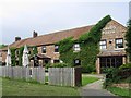
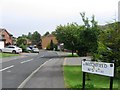
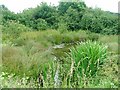
11 photos from this area
Area Information
Key information about the TS8 0SU including its size, population, and administrative classification.
- Area Type
- Postcode
- Area Size
- 2.9 hectares
- Population
- 1209
- Population Density
- 3352 people/km²
House Prices in TS8 0SU
73
Properties
£100,028
Average Sold Price
£22,000
Lowest Price
£152,500
Highest Price
Showing 73 properties
| Address | Type | Beds | Baths | Last Sale Price | Last Sale Date | |
|---|---|---|---|---|---|---|
| 117 Lingfield Ash, Middlesbrough, TS8 0SU | Flat | - | - | £70,000 | Mar 2025 | |
| 140 Lingfield Ash, Middlesbrough, TS8 0SU | house | - | - | £110,000 | Dec 2023 | |
| 139 Lingfield Ash, Middlesbrough, TS8 0SU | house | - | - | £130,000 | Apr 2023 | |
| 99 Lingfield Ash, Middlesbrough, TS8 0SU | Flat | - | - | £75,000 | Nov 2022 | |
| 127 Lingfield Ash, Middlesbrough, TS8 0SU | Semi-detached | 3 | - | £112,000 | Sep 2022 | |
| 147 Lingfield Ash, Middlesbrough, TS8 0SU | house | - | - | £145,000 | Apr 2022 | |
| 144 Lingfield Ash, Middlesbrough, TS8 0SU | house | - | - | £129,000 | Sep 2021 | |
| 79 Lingfield Ash, Middlesbrough, TS8 0SU | Flat | - | - | £65,000 | Jun 2021 | |
| 132 Lingfield Ash, Middlesbrough, TS8 0SU | house | - | - | £120,000 | Jan 2021 | |
| 107 Lingfield Ash, Middlesbrough, TS8 0SU | Flat | 1 | 1 | £62,000 | Jul 2019 |
Page 1 of 8
Energy Efficiency in TS8 0SU
Amenities
Schools
| Rank | School | Type | Entry gender | Ages |
|---|
Explore more schools in this area
Go to Schools tabDemographics
Household Size
One person
most common
Accommodation Type
Houses
most common
Tenure
35
majority
Ethnic Group
White
most common
Religion
N/A
most common
Household Composition
N/A
most common
Age
47
median
Adults (30-64 years)
most common
Household Deprivation
N/A
with no deprivation
NS-SEC
17
in Lower managerial occupations
Explore more demographic insights in this area
Go to Demographics tabPlanning
Planning Constraints
- Flood RiskPremium
- Ramsar Wetland SitesPremium
- Area of Outstanding Natural BeautyPremium
- Protected Nature ReservePremium
- Protected WoodlandPremium