Area Overview for NE40 4BD
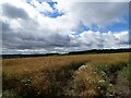
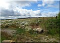
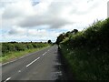
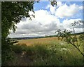
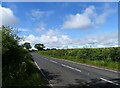
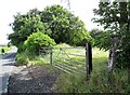
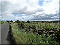
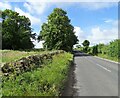
Photos of NE40 4BD
Area Information
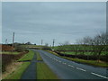
Living in NE40 4BD means inhabiting a small, tightly knit residential cluster in England. The area covers 2,424 square metres and is home to 1,986 people, giving it a population density of 906 people per square kilometre. This compact postcode area is characterised by a balance of residential tranquillity and practical accessibility. With its modest size, NE40 4BD offers a sense of community that is often absent in larger urban zones. Daily life here is shaped by proximity to essential services, including retail outlets and public transport links. The area’s compact nature means residents can reach nearby amenities quickly, making it ideal for those prioritising convenience without sacrificing space. While the data does not specify historical or cultural landmarks, the presence of multiple rail stations and a metro stop suggests it is strategically positioned within a broader network of connectivity. For those seeking a blend of residential comfort and practicality, NE40 4BD provides a straightforward, no-frills living environment.
- Area Type
- Postcode
- Area Size
- 2424 m²
- Population
- 1986
- Population Density
- 906 people/km²
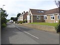
The property market in NE40 4BD is defined by a high rate of home ownership (71%) and a predominance of houses. This indicates that the area is not a rental hotspot but rather one where residents are more likely to own their properties. The focus on houses, rather than flats or apartments, suggests a preference for larger, more private living spaces, which may appeal to families or individuals seeking space. Given the area’s small size, the housing stock is limited, meaning buyers must consider the immediate surroundings for more options. The high home ownership rate also implies a stable market with fewer vacant properties, potentially reducing competition for buyers. However, the lack of detailed data on property prices or recent trends means that the market’s affordability or growth potential remains unexplored. For those prioritising ownership and space, NE40 4BD offers a straightforward, if limited, selection of homes.
House Prices in NE40 4BD
Showing 8 properties
Energy Efficiency in NE40 4BD
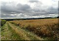
The lifestyle in NE40 4BD is shaped by its proximity to essential amenities. Retail options include Morrisons Daily, Co-op Crawcrook, and Co-op Ryton, providing access to groceries and everyday goods. These shops are within practical reach, reducing the need for long journeys. The area’s rail stations—Wylam, Prudhoe, and Blaydon—offer connections to broader networks, while the Bank Foot metro stop adds further accessibility. Though the data does not mention parks or leisure facilities, the presence of multiple retail and transport hubs suggests a functional, community-oriented environment. The compact nature of NE40 4BD means residents can access these amenities quickly, supporting a lifestyle that balances convenience with a sense of local identity. The combination of shops, transport, and nearby schools creates a practical, if modest, living experience.
Amenities
Schools
The nearest school to NE40 4BD is Greenside Primary School, which holds an outstanding Ofsted rating. This primary school is a key asset for families in the area, offering a high standard of education that is rare in many regions. The absence of secondary schools or other educational institutions in the data means that families may need to look beyond NE40 4BD for comprehensive schooling. However, the presence of an outstanding primary school suggests that the area is well-served for younger children, reducing the need for long commutes. For parents prioritising quality education, Greenside Primary’s rating is a strong selling point. The data does not mention other schools, so buyers should consider proximity to secondary education as part of their decision-making process.
| Rank | School | Type | Entry gender | Ages |
|---|
Explore more schools in this area
Go to Schools tabDemographics
The community in NE40 4BD is predominantly composed of adults aged 30–64, with a median age of 47. This age range suggests a mix of established professionals and families, reflecting a stable, mature demographic. Home ownership is high at 71%, indicating a strong presence of long-term residents and a lower proportion of rental properties. The accommodation type is primarily houses, which aligns with the area’s residential character and contributes to a sense of privacy and space. The predominant ethnic group is White, which, while not providing data on diversity, implies a homogenous community profile. The population density of 906 people per square kilometre is relatively high for a small postcode area, suggesting a compact, closely populated environment. This density may influence local dynamics, such as shared community spaces and proximity to amenities. The data does not specify deprivation levels, but the high home ownership and age profile suggest a generally stable quality of life.
Household Size
Accommodation Type
Tenure
Ethnic Group
Religion
Household Composition
Age
Household Deprivation
NS-SEC
Explore more demographic insights in this area
Go to Demographics tabPlanning
Planning Constraints
- Flood RiskPremium
- Ramsar Wetland SitesPremium
- Area of Outstanding Natural BeautyPremium
- Protected Nature ReservePremium
- Protected WoodlandPremium