Area Overview for NE40 4AT
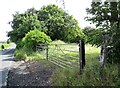
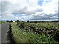
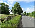
Photos of NE40 4AT

Area Information
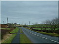
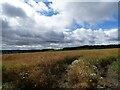
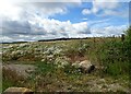
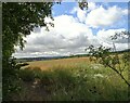
Living in NE40 4AT means being part of a tightly knit residential cluster in England, where 1,710 people reside across 1.3 hectares. The area’s compact size creates a sense of community, with a population density of 1,369 people per square kilometre. This postcode is not a sprawling suburb but a focused cluster of homes, ideal for those seeking a quieter, more intimate living environment. The presence of nearby rail stations, including Wylam and Prudhoe, connects residents to surrounding towns, while local shops like Morrisons and Co-op provide daily essentials. Daily life here is shaped by proximity to retail and transport, with a balance between convenience and space. The area’s low crime risk and absence of environmental constraints make it appealing for families and professionals. With a median age of 47, the community is predominantly adults aged 30–64, suggesting a stable, established population. For buyers, NE40 4AT offers a blend of practicality and accessibility, though its small size means it’s best suited for those prioritising location over expansive living space.
- Area Type
- Postcode
- Area Size
- 1.3 hectares
- Population
- 1710
- Population Density
- 1369 people/km²
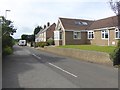
The property market in NE40 4AT is characterised by high home ownership, with 80% of residents living in their own homes. This suggests a stable, owner-occupied market rather than a rental-dominated one. The accommodation type is predominantly houses, which is unusual for a small postcode area but may indicate a focus on family homes or larger properties. Given the area’s size and population density, the housing stock is likely limited to a few dozen homes, making it a niche market. Buyers should consider the small scale of the area, which may restrict availability and competition. The presence of nearby rail links and retail amenities adds to the appeal, but the lack of larger housing developments means this is not a place for those seeking expansive properties. For those prioritising security and a quiet lifestyle, NE40 4AT’s property market offers a blend of stability and proximity to essential services.
House Prices in NE40 4AT
Showing 12 properties
| Address | Type | Beds | Baths | Last Sale Price | Last Sale Date | |
|---|---|---|---|---|---|---|
| South View, Rockwood Hill Road, Greenside, Ryton, NE40 4AT | house | - | - | £518,445 | Nov 2021 | |
| Beecholme, Rockwood Hill Road, Greenside, Ryton, NE40 4AT | house | - | - | £330,000 | Sep 2021 | |
| The Arches, Rockwood Hill Road, Greenside, Ryton, NE40 4AT | Detached | 4 | 4 | £280,000 | Oct 2018 | |
| Birchwood, Rockwood Hill Road, Greenside, Ryton, NE40 4AT | Detached | 3 | - | £195,000 | Aug 2013 | |
| Hopwood House, Rockwood Hill Road, Greenside, Ryton, NE40 4AT | Semi-detached | - | - | £250,000 | Nov 2008 | |
| Marlbry, Rockwood Hill Road, Greenside, Ryton, NE40 4AT | Detached | - | - | £88,500 | Oct 1996 | |
| The Old Mission, Rockwood Hill Road, Greenside, Ryton, NE40 4AT | Bungalow | 3 | 1 | - | - | |
| Rockwood East, Rockwood Hill Road, Greenside, Ryton, NE40 4AT | Detached | 3 | 2 | - | - | |
| Mission House, Rockwood Hill Road, Greenside, Ryton, NE40 4AT | Detached | - | - | - | - | |
| The Willows, Rockwood Hill Road, Greenside, Ryton, NE40 4AT | Bungalow | - | - | - | - |
Energy Efficiency in NE40 4AT
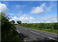
Residents of NE40 4AT have access to essential retail and transport hubs within practical reach. Local shops such as Morrisons Daily, Co-op Crawcrook, and Co-op Wylam provide groceries and daily necessities, reducing the need for long trips. The nearby rail stations—Wylam, Prudhoe, and Blaydon Railway Station—offer direct connections to surrounding areas, making commuting or visiting nearby towns straightforward. While the area lacks large parks or leisure facilities, the compact layout ensures amenities are easily accessible on foot or by bike. The presence of multiple retail options and transport links contributes to a convenient, low-maintenance lifestyle. For those who prioritise proximity to services over expansive recreational spaces, NE40 4AT’s small footprint delivers a functional, community-focused environment. The absence of major entertainment venues or green spaces, however, may appeal more to those seeking simplicity than to those desiring a vibrant, amenity-rich lifestyle.
Amenities
Schools
| Rank | School | Type | Entry gender | Ages |
|---|
Explore more schools in this area
Go to Schools tabDemographics
NE40 4AT has a median age of 47, with the majority of residents falling within the 30–64 age range. This indicates a mature, stable population, likely composed of working-age adults and older professionals. Home ownership is high, at 80%, reflecting a community where most residents live in their own homes rather than renting. The accommodation type is predominantly houses, which aligns with the area’s compact, residential character. The predominant ethnic group is White, making up the majority of the population. While no specific data on deprivation is provided, the high home ownership rate and low crime risk suggest a relatively affluent and secure environment. The absence of significant diversity data means the area’s cultural makeup is not explicitly detailed, but the demographic profile points to a cohesive, middle-aged community with established roots.
Household Size
Accommodation Type
Tenure
Ethnic Group
Religion
Household Composition
Age
Household Deprivation
NS-SEC
Explore more demographic insights in this area
Go to Demographics tabPlanning
Planning Constraints
- Flood RiskPremium
- Ramsar Wetland SitesPremium
- Area of Outstanding Natural BeautyPremium
- Protected Nature ReservePremium
- Protected WoodlandPremium