Area Overview for NE40 4BG
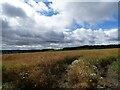
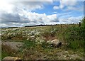
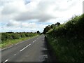
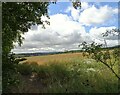
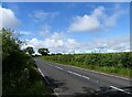
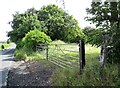
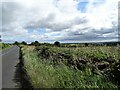
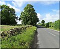
Photos of NE40 4BG
Area Information
Living in NE40 4BG means being part of a compact, residential cluster in northeast England. The area spans just 1.3 hectares, housing 1,986 residents in a densely populated 906 people per square kilometre. This small postcode is defined by its quiet, established character, with a focus on family-oriented living. The proximity to rail links and local amenities makes it practical for daily life, while the low population density suggests a balance between community and space. Residents benefit from a mix of nearby shops, schools, and transport options, creating a self-contained environment. The area’s appeal lies in its accessibility to larger towns via rail, combined with the intimacy of a small, tightly knit neighbourhood. With a median age of 47, it caters to adults in their prime earning years, many of whom are homeowners. This blend of practicality and quiet living makes NE40 4BG a compelling choice for those seeking a manageable, connected lifestyle without the sprawl of larger urban areas.
- Area Type
- Postcode
- Area Size
- 1.3 hectares
- Population
- 1986
- Population Density
- 906 people/km²
NE40 4BG is primarily an owner-occupied area, with 71% of homes owned by residents rather than rented. The accommodation type is predominantly houses, which is unusual for a small postcode but suggests a focus on family-sized properties. This contrasts with areas dominated by flats or rental stock, indicating a community of long-term residents rather than transient populations. The limited area size means the housing stock is constrained, with few new developments likely. For buyers, this implies a niche market with limited availability, where properties are likely to be in established condition. The proximity to rail links and schools may enhance the appeal of homes here, particularly for families. However, the small size of the area means buyers should consider nearby suburbs for broader options, though the immediate surroundings may share similar characteristics.
House Prices in NE40 4BG
Showing 22 properties
| Address | Type | Beds | Baths | Last Sale Price | Last Sale Date | |
|---|---|---|---|---|---|---|
| 14 Rockwood Hill Estate, Greenside, Ryton, NE40 4BG | house | 4 | 1 | £245,000 | Sep 2023 | |
| 22 Rockwood Hill Estate, Greenside, Ryton, NE40 4BG | house | - | - | £81,000 | Feb 2022 | |
| 12 Rockwood Hill Estate, Greenside, Ryton, NE40 4BG | house | - | - | £157,500 | Feb 2022 | |
| 11 Rockwood Hill Estate, Greenside, Ryton, NE40 4BG | house | - | - | £80,000 | Dec 2019 | |
| 6 Rockwood Hill Estate, Greenside, Ryton, NE40 4BG | Semi-detached | 5 | 1 | £175,000 | Apr 2018 | |
| 21 Rockwood Hill Estate, Greenside, Ryton, NE40 4BG | Semi-detached | 3 | 1 | £118,000 | Feb 2016 | |
| 8 Rockwood Hill Estate, Greenside, Ryton, NE40 4BG | Semi-detached | - | - | £124,950 | Nov 2007 | |
| 16 Rockwood Hill Estate, Greenside, Ryton, NE40 4BG | Semi-detached | - | - | £135,000 | Jun 2006 | |
| 9 Rockwood Hill Estate, Greenside, Ryton, NE40 4BG | Semi-detached | - | - | £22,500 | Mar 1998 | |
| 17 Rockwood Hill Estate, Greenside, Ryton, NE40 4BG | Semi-detached | - | - | £31,000 | Jan 1997 |
Energy Efficiency in NE40 4BG
Residents of NE40 4BG have access to a range of nearby amenities, including five retail outlets such as Morrisons Daily, Co-op Crawcrook, and Co-op Ryton. These shops provide essential services, from groceries to everyday purchases, reducing the need for long trips. The rail stations nearby—Wylam, Prudhoe, and Blaydon—offer easy access to larger towns, enhancing the area’s connectivity. While the data does not specify parks or leisure facilities, the presence of multiple retail options and rail links suggests a practical, community-focused lifestyle. The compact nature of the area means amenities are within walking or short driving distance, fostering convenience. The availability of local shops and transport options supports a self-sufficient daily life, with minimal disruption for errands or travel. This mix of retail and transport infrastructure ensures residents can meet their needs without leaving the immediate vicinity.
Amenities
Schools
The nearest school to NE40 4BG is Greenside Primary School, which holds an outstanding Ofsted rating. This indicates a high standard of education for younger children, though no secondary schools are listed in the data. The presence of a primary school with an outstanding rating is a significant draw for families with young children, ensuring access to quality early education. However, the absence of secondary school information means parents may need to look further afield for secondary education. The school’s proximity to the area suggests it serves a broader local community, potentially including nearby postcodes. For families prioritising strong primary education, Greenside Primary School provides a clear advantage, though the lack of secondary options is a practical consideration for long-term planning.
| Rank | School | Type | Entry gender | Ages |
|---|
Explore more schools in this area
Go to Schools tabDemographics
The community in NE40 4BG is predominantly composed of adults aged 30–64, with a median age of 47. This reflects a mature, stable population, many of whom are likely in their peak working years. Home ownership is high, at 71%, with houses being the primary type of accommodation. The predominant ethnic group is White, which aligns with broader regional demographics. The absence of specific data on diversity or deprivation means the area’s social makeup remains largely unexplored in public records. However, the high home ownership rate suggests a long-term presence of residents, contributing to a sense of continuity. With no indication of significant deprivation, the quality of life appears to be supported by stable housing and accessible services. The compact size of the area means its demographics are likely homogeneous, with limited variation in household composition or socioeconomic status.
Household Size
Accommodation Type
Tenure
Ethnic Group
Religion
Household Composition
Age
Household Deprivation
NS-SEC
Explore more demographic insights in this area
Go to Demographics tabPlanning
Planning Constraints
- Flood RiskPremium
- Ramsar Wetland SitesPremium
- Area of Outstanding Natural BeautyPremium
- Protected Nature ReservePremium
- Protected WoodlandPremium