Area Overview for DL14 8YW
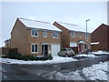
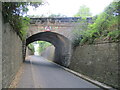
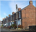
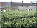
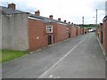
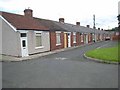
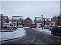
Photos of DL14 8YW

Area Information
Living in DL14 8YW means residing in a compact residential cluster defined by its specific postcode location in County Durham. This small area spans just 1.6 hectares and houses a population of 1,580 people, resulting in a density of 574 people per square kilometre. The environment is closely packed, offering a neighbourhood feel where local residents interact frequently within a defined boundary. You will find this postcode covers a specific residential cluster that prioritises proximity over sprawling expanses. Daily life revolves around managing distance to essential services, as the area itself is relatively self-contained in terms of land mass but connected to wider infrastructure. The community size suggests a neighbourhood where businesses rely on local footfall and neighbours recognise one another quickly. If you are considering homes in DL14 8YW, you are entering a location where density and accessibility play a central role in the lived experience. This is a place where the physical footprint of the housing estate is small, yet the need for external connections to shops and transport remains constant for the residents.
- Area Type
- Postcode
- Area Size
- 1.6 hectares
- Population
- 1580
- Population Density
- 574 people/km²
You are looking at a property market in DL14 8YW defined by consistency and traditional housing stock. The area is primarily owner-occupied, with 58% of households claiming ownership of their homes. This high rate of ownership indicates a market driven by long-term residents rather than speculative investors or transient tenants. Houses represent the dominant accommodation type, so you will not find blocks of flats or purpose-built apartments within this specific postcode. The housing stock consists of conventional detached or semi-detached properties suited to the local family demographic. For buyers seeking homes in DL14 8YW, this means transactions often involve existing structures established over decades rather than new builds or rental conversions. The area caters to those who value the stability of ownership and the space that comes with house living. Because the population density is 574 people per square kilometre, land value remains significant despite the small total area size of 1.6 hectares. You should approach this market with the expectation of finding permanent family residences that serve the core needs of the local 1,580-resident population.
House Prices in DL14 8YW
Showing 22 properties
| Address | Type | Beds | Baths | Last Sale Price | Last Sale Date | |
|---|---|---|---|---|---|---|
| 23 Morton Close, Auckland Park, DL14 8YW | Detached | 4 | 2 | £168,000 | Oct 2024 | |
| 5 Morton Close, Auckland Park, DL14 8YW | Detached | 3 | 1 | £150,000 | Aug 2022 | |
| 11 Morton Close, Auckland Park, DL14 8YW | house | 3 | - | £100,000 | Jul 2018 | |
| 9 Morton Close, Auckland Park, DL14 8YW | house | 3 | - | £120,000 | Feb 2018 | |
| 18 Morton Close, Auckland Park, DL14 8YW | Detached | 3 | 2 | £102,000 | Jan 2018 | |
| 19 Morton Close, Auckland Park, DL14 8YW | Detached | 4 | 1 | £120,000 | Nov 2017 | |
| 7 Morton Close, Auckland Park, DL14 8YW | Detached | 3 | 2 | £122,000 | Oct 2017 | |
| 2 Morton Close, Auckland Park, DL14 8YW | Detached | 4 | 1 | £157,000 | Feb 2016 | |
| 4 Morton Close, Auckland Park, DL14 8YW | house | 4 | - | £125,000 | Jun 2014 | |
| 22 Morton Close, Auckland Park, DL14 8YW | house | - | - | £120,000 | Sep 2009 |
Energy Efficiency in DL14 8YW
Your lifestyle in DL14 8YW benefits from a reasonable network of amenities within practical reach. For retail needs, you have access to five notable convenience outlets including Spar Parkhead, Asda Bishop, and Morrisons Toronto. These shops provide essential groceries and household goods without requiring long drives. The retail category supports daily errands and essential shopping trips efficiently. Transport options extend your lifestyle reach with five notable rail stations including Bishop Auckland Railway Station, Bishop Auckland West Weardale Railway Station, and Shildon Railway Station. These stations allow you to commute to larger employment centres or enjoy weekend trips without relying solely on the road network. The combination of supermarket access and rail links creates a balanced environment where you handle local shopping and longer travels with ease. You will find that the amenities listed are focused on practicality, offering the core services required for independent living. This setup ensures that daily life in DL14 8YW is convenient and connected to the wider county infrastructure.
Amenities
Schools
Families living in DL14 8YW have access to a select group of educational institutions nearby. Three primary schools serve the area, offering foundational education to young children in the neighbourhood. Dene Valley Primary School provides local education for younger students in the postcode vicinity. Eldon Lane Primary School functions as another option for primary education near your home. Prince Bishops Community Primary School also serves the area and holds a good Ofsted rating, which indicates a standard of education that meets national expectations. The exclusion of secondary schools from this immediate list means parents must consider travel distances for upper schooling, though the primary options are present within practical reach. The presence of three primary choices offers parents some selectivity without the complexity of large urban school systems. You will find that the local education landscape is focused on early childhood and primary years. This setup supports families who prioritise proximity to state-funded primary education. The mix of providers ensures that there is a dedicated focus on the developmental needs of children up to the age of 11.
| Rank | School | Type | Entry gender | Ages |
|---|
Explore more schools in this area
Go to Schools tabDemographics
The community in DL14 8YW is dominated by adults, with the 30-64 year age range being the most common demographic group. The median age stands at 47 years, indicating a steady, established population rather than a youthful market or a retirement community. You will find that 58% of households are owner-occupied, suggesting a stable community where families and long-term residents value security in their properties. Houses form the primary accommodation type, meaning the area lacks flats or apartment blocks and consists of traditional family housing structures. The predominant ethnic group is White, reflecting a homogeneous cultural landscape typical of many established English towns. This demographic profile creates a quiet, settled atmosphere where residents have likely been living there for many years. The high home ownership rate combined with the age profile points to a neighbourhood of stability where people invest in their local environment. When you consider living in DL14 8YW, you are joining a society of homeowners who have put down deep roots in this specific postcode area.
Household Size
Accommodation Type
Tenure
Ethnic Group
Religion
Household Composition
Age
Household Deprivation
NS-SEC
Explore more demographic insights in this area
Go to Demographics tabPlanning
Planning Constraints
- Flood RiskPremium
- Ramsar Wetland SitesPremium
- Area of Outstanding Natural BeautyPremium
- Protected Nature ReservePremium
- Protected WoodlandPremium