Area Overview for DL14 8RH
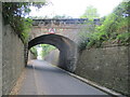
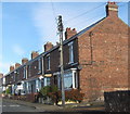
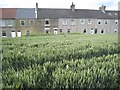
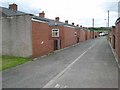
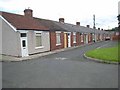
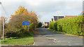
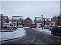
Photos of DL14 8RH

Area Information
DL14 8RH is a compact residential postcode in England, home to 1,580 people spread across a densely populated area with 574 residents per square kilometre. This small cluster of homes is characterised by its proximity to local amenities and transport links, making it a practical choice for those seeking a balance between urban convenience and residential tranquillity. The area’s population skew towards adults aged 30–64 suggests a mature community, likely with established families and professionals. Daily life here is shaped by the availability of nearby schools, retail outlets, and rail stations, which support a self-contained lifestyle. While the area is small, its strategic location offers access to broader regional networks, including major roads and public transport. The mix of housing types and ownership patterns indicates a stable, long-term resident base, with many properties likely to be family homes. For buyers, DL14 8RH presents an opportunity to enter a tightly knit community with clear local needs and infrastructure in place.
- Area Type
- Postcode
- Area Size
- Not available
- Population
- 1580
- Population Density
- 574 people/km²
DL14 8RH is predominantly a home-ownership area, with 58% of properties owned by residents rather than rented. The accommodation type is largely houses, which implies a focus on single-family dwellings rather than flats or apartments. This suggests a market skewed towards established homeowners, with limited rental availability. The small size of the postcode means the housing stock is likely limited in scale, potentially offering fewer options for buyers seeking a wide range of properties. For those considering the area, the predominance of houses may appeal to families or professionals seeking more space and privacy. However, the compact nature of the area also means buyers should evaluate the immediate surroundings for additional housing opportunities. The owner-occupied profile indicates a stable market, but the limited size of DL14 8RH itself may restrict property diversity.
House Prices in DL14 8RH
No properties found in this postcode.
Energy Efficiency in DL14 8RH
Residents of DL14 8RH benefit from a range of nearby amenities, including five retail outlets such as Asda Bishop, Spar Parkhead, and Morrisons Toronto. These shops provide access to everyday essentials, reducing the need for long trips to larger centres. The presence of multiple rail stations, including Bishop Auckland and Shildon, adds to the area’s connectivity, enabling easy travel for shopping, work, or leisure. While the data does not specify parks or leisure facilities, the proximity to rail and retail suggests a lifestyle focused on convenience and accessibility. The mix of local shops and transport options supports a practical, community-oriented daily life, with residents able to meet most needs within the immediate vicinity. This blend of retail and transport infrastructure contributes to a self-sufficient, manageable living environment.
Amenities
Schools
Residents of DL14 8RH have access to three primary schools within practical reach: Dene Valley Primary School, Eldon Lane Primary School, and Prince Bishops Community Primary School. The latter holds an Ofsted rating of 'good', which reflects its performance in education standards and student outcomes. The presence of multiple primary schools provides families with options, though no secondary schools are listed in the data. This suggests that parents may need to consider nearby areas for secondary education. The availability of primary schools within the postcode is a key advantage for families, as it reduces the need for long commutes. However, the absence of detailed information on school catchment areas or capacity means prospective buyers should verify enrollment policies independently.
| Rank | School | Type | Entry gender | Ages |
|---|
Explore more schools in this area
Go to Schools tabDemographics
The population of DL14 8RH has a median age of 47, with the majority of residents falling within the 30–64 age range. This suggests a community of established adults, many of whom may be in their prime working years or nearing retirement. Home ownership rates stand at 58%, indicating a mix of owner-occupied properties and rental units. The predominant accommodation type is houses, which aligns with the area’s residential character and likely contributes to a more settled demographic. The predominant ethnic group is White, reflecting a homogenous community profile. While no specific data on deprivation is provided, the age distribution and home ownership figures suggest a relatively stable socioeconomic environment. The absence of detailed diversity metrics means the community’s broader cultural composition remains unspecified, but the data confirms a focus on long-term, family-oriented living.
Household Size
Accommodation Type
Tenure
Ethnic Group
Religion
Household Composition
Age
Household Deprivation
NS-SEC
Explore more demographic insights in this area
Go to Demographics tabPlanning
Planning Constraints
- Flood RiskPremium
- Ramsar Wetland SitesPremium
- Area of Outstanding Natural BeautyPremium
- Protected Nature ReservePremium
- Protected WoodlandPremium