Area Overview for DL14 8BD
Photos of DL14 8BD
Area Information
DL14 8BD is a compact residential postcode in England, covering just 2.5 hectares and home to 1,580 residents. Its small size means it is a tightly knit community, with a population density of 574 people per square kilometre. The area is characterised by a mature demographic, with a median age of 47 and the majority of residents aged between 30 and 64. This suggests a stable, established community with a focus on family life and long-term residency. Daily life here is shaped by proximity to essential services, including five retail outlets and multiple rail stations, which provide easy access to nearby towns and cities. The area’s modest size ensures a quiet, low-traffic environment, though it remains well-connected to broader networks. With no major planning constraints or environmental protections, DL14 8BD is a practical choice for those seeking a balanced mix of residential comfort and accessibility. Its appeal lies in its simplicity: a small, functional postcode with no overt urban sprawl, ideal for those prioritising convenience over grandeur.
- Area Type
- Postcode
- Area Size
- 2.5 hectares
- Population
- 1580
- Population Density
- 574 people/km²
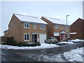
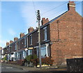
DL14 8BD is a small, owner-occupied area with a clear focus on houses rather than flats or apartments. With 58% of residents owning their homes, the market is likely to be more stable than a high-rental area, though the limited size of the postcode means the housing stock is not extensive. The predominance of houses suggests a traditional, low-density development, which may appeal to families or those seeking more space. However, the small area size means property choices are limited, and buyers may need to consider nearby postcodes for more options. The lack of planning constraints or protected sites implies fewer restrictions on development, which could be a benefit for those seeking to renovate or expand. For buyers, the key consideration is the balance between the area’s compactness and its proximity to amenities, which may offset the limited housing supply.
House Prices in DL14 8BD
Showing 40 properties
| Address | Type | Beds | Baths | Last Sale Price | Last Sale Date | |
|---|---|---|---|---|---|---|
| 40 St Phillips Close, Auckland Park, DL14 8BD | Detached | 4 | 2 | £238,000 | Jun 2025 | |
| 29 St Phillips Close, Auckland Park, DL14 8BD | Detached | 4 | 1 | £222,500 | Jan 2023 | |
| 19 St Phillips Close, Auckland Park, DL14 8BD | Detached | 3 | - | £180,000 | Jul 2022 | |
| 38 St Phillips Close, Auckland Park, DL14 8BD | Retail | 4 | - | £222,500 | Mar 2022 | |
| 17 St Phillips Close, Auckland Park, DL14 8BD | house | - | - | £240,000 | Dec 2021 | |
| 32 St Phillips Close, Auckland Park, DL14 8BD | house | 4 | - | £177,500 | Oct 2021 | |
| Coalfield House, 10 St Phillips Close, Auckland Park, DL14 8BD | house | - | - | £151,000 | Oct 2021 | |
| 21 St Phillips Close, Auckland Park, DL14 8BD | house | - | - | £150,000 | May 2021 | |
| 35 St Phillips Close, Auckland Park, DL14 8BD | house | - | - | £139,500 | Dec 2020 | |
| 2 St Phillips Close, Auckland Park, DL14 8BD | Detached | 4 | - | £172,000 | Jun 2020 |
Energy Efficiency in DL14 8BD
Residents of DL14 8BD have access to a range of nearby amenities, including five retail outlets such as Spar Parkhead, Asda Bishop, and Sainsburys Coundon. These shops provide everyday convenience, from groceries to household essentials. The rail network further enhances accessibility, with stations like Bishop Auckland and Shildon offering connections to broader regional hubs. While the area itself is small, the proximity to these amenities ensures a functional lifestyle without the need for long journeys. The lack of detailed information on parks or leisure facilities means it is unclear whether there are green spaces for recreation, but the presence of multiple retail and transport options suggests a practical, community-focused environment. For those prioritising convenience over expansive leisure opportunities, DL14 8BD offers a straightforward, accessible lifestyle.
Amenities
Schools
Residents of DL14 8BD have access to three primary schools: Dene Valley Primary School, Eldon Lane Primary School, and Prince Bishops Community Primary School. The latter holds an Ofsted rating of ‘good’, indicating a reliable standard of education. The presence of multiple primary schools within practical reach is a significant advantage for families, reducing the need for long commutes. However, no secondary schools are listed in the data, which may require residents to travel to nearby towns for further education. The mix of schools suggests a range of options, though the absence of detailed performance metrics means it is unclear whether one school stands out in terms of academic results or facilities. For parents prioritising primary education, the proximity of these schools is a tangible benefit, but secondary schooling may necessitate additional planning.
| Rank | School | Type | Entry gender | Ages |
|---|
Explore more schools in this area
Go to Schools tabDemographics
The community in DL14 8BD is predominantly composed of adults aged 30 to 64, with a median age of 47. This indicates a mature population, likely with established careers and family structures. Home ownership is strong, with 58% of residents owning their homes, suggesting a stable housing market and long-term commitment to the area. The accommodation type is primarily houses, which aligns with the demographic profile of older, settled residents. The predominant ethnic group is White, reflecting a homogenous community. The population density of 574 people per square kilometre is moderate, balancing residential space with community interaction. While no specific data on deprivation is provided, the high home ownership rate and age profile suggest a relatively stable economic environment. However, the absence of detailed diversity metrics means the community’s social composition remains largely unexplored in the data.
Household Size
Accommodation Type
Tenure
Ethnic Group
Religion
Household Composition
Age
Household Deprivation
NS-SEC
Explore more demographic insights in this area
Go to Demographics tabPlanning
Planning Constraints
- Flood RiskPremium
- Ramsar Wetland SitesPremium
- Area of Outstanding Natural BeautyPremium
- Protected Nature ReservePremium
- Protected WoodlandPremium