Area Overview for DH1 1RB
Photos of DH1 1RB
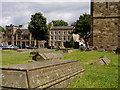
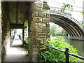
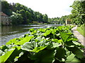
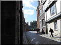
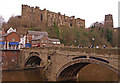
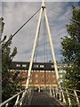
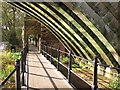
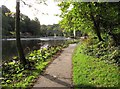
100 photos from this area
Area Information
Key information about the DH1 1RB including its size, population, and administrative classification.
- Area Type
- Postcode
- Area Size
- 1.2 hectares
- Population
- 6464
- Population Density
- 1138 people/km²
House Prices in DH1 1RB
22
Properties
£196,732
Average Sold Price
£68,000
Lowest Price
£412,500
Highest Price
Showing 22 properties
| Address | Type | Beds | Baths | Last Sale Price | Last Sale Date | |
|---|---|---|---|---|---|---|
| 10 Hillcrest, Durham, DH1 1RB | house | - | - | £260,000 | Mar 2025 | |
| The Folly, Hillcrest, Durham, DH1 1RB | Bungalow | 3 | 1 | £412,500 | Aug 2024 | |
| 1A Hillcrest, Durham, DH1 1RB | Flat | 3 | 2 | £216,000 | Jul 2022 | |
| 2 Hillcrest, Durham, DH1 1RB | house | - | - | £215,000 | Nov 2020 | |
| 1 Hillcrest, Durham, DH1 1RB | house | - | - | £170,000 | Aug 2017 | |
| 7 Hillcrest, Durham, DH1 1RB | house | 3 | - | £189,000 | Aug 2014 | |
| Cartref, Hillcrest, Durham, DH1 1RB | Bungalow | 3 | - | £250,000 | Jul 2014 | |
| Avalon, Hillcrest, Durham, DH1 1RB | Detached | 3 | - | £250,000 | Jan 2014 | |
| 6 Hillcrest, Durham, DH1 1RB | Terraced | - | - | £163,000 | Jul 2013 | |
| Longridge, Hillcrest, Durham, DH1 1RB | Bungalow | 4 | - | £330,000 | Nov 2012 |
Page 1 of 3
Energy Efficiency in DH1 1RB
Amenities
Schools
| Rank | School | Type | Entry gender | Ages |
|---|
Explore more schools in this area
Go to Schools tabDemographics
Household Size
One person
most common
Accommodation Type
Houses
most common
Tenure
25
majority
Ethnic Group
White
most common
Religion
N/A
most common
Household Composition
N/A
most common
Age
22
median
Young Adults (15-29 years)
most common
Household Deprivation
N/A
with no deprivation
NS-SEC
5
in Lower managerial occupations
Explore more demographic insights in this area
Go to Demographics tabPlanning
Planning Constraints
- Flood RiskPremium
- Ramsar Wetland SitesPremium
- Area of Outstanding Natural BeautyPremium
- Protected Nature ReservePremium
- Protected WoodlandPremium