Area Overview for W5 1JQ
Photos of W5 1JQ
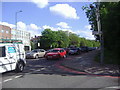
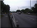
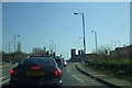
100 photos from this area
Area Information
Key information about the W5 1JQ including its size, population, and administrative classification.
- Area Type
- Postcode
- Area Size
- 1.0 hectares
- Population
- 1492
- Population Density
- 5902 people/km²
House Prices in W5 1JQ
25
Properties
£668,467
Average Sold Price
£160,000
Lowest Price
£1,220,000
Highest Price
Showing 25 properties
| Address | Type | Beds | Baths | Last Sale Price | Last Sale Date | |
|---|---|---|---|---|---|---|
| 51 Lynwood Road, Ealing, W5 1JQ | house | - | - | £1,020,000 | Jun 2021 | |
| 43 Lynwood Road, Ealing, W5 1JQ | Semi-detached | 4 | 1 | £1,220,000 | Jun 2021 | |
| 21 Lynwood Road, Ealing, W5 1JQ | Terraced | 4 | 2 | £906,000 | Sep 2018 | |
| 33 Lynwood Road, Ealing, W5 1JQ | Detached | 5 | 4 | £900,000 | Dec 2016 | |
| 49 Lynwood Road, Ealing, W5 1JQ | Semi-detached | 5 | 2 | £1,010,000 | Mar 2016 | |
| 41 Lynwood Road, Ealing, W5 1JQ | house | 4 | - | £930,000 | Dec 2014 | |
| 23 Lynwood Road, Ealing, W5 1JQ | house | - | - | £390,000 | Jun 2014 | |
| 11 Lynwood Road, Ealing, W5 1JQ | house | 6 | 2 | £574,000 | Mar 2013 | |
| 13 Lynwood Road, Ealing, W5 1JQ | Land | - | - | £468,000 | Dec 2011 | |
| 25 Lynwood Road, Ealing, W5 1JQ | house | - | - | £488,000 | Nov 2010 |
Page 1 of 3
Energy Efficiency in W5 1JQ
Amenities
Schools
| Rank | School | Type | Entry gender | Ages |
|---|
Explore more schools in this area
Go to Schools tabDemographics
Household Size
Family (3-5 people)
most common
Accommodation Type
Houses
most common
Tenure
84
majority
Ethnic Group
White
most common
Religion
N/A
most common
Household Composition
N/A
most common
Age
47
median
Adults (30-64 years)
most common
Household Deprivation
N/A
with no deprivation
NS-SEC
60
in Lower managerial occupations
Explore more demographic insights in this area
Go to Demographics tabPlanning
Planning Constraints
- Flood RiskPremium
- Ramsar Wetland SitesPremium
- Area of Outstanding Natural BeautyPremium
- Protected Nature ReservePremium
- Protected WoodlandPremium