Area Overview for W5 1LE
Photos of W5 1LE

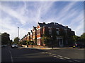

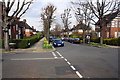
57 photos from this area
Area Information
Key information about the W5 1LE including its size, population, and administrative classification.
- Area Type
- Postcode
- Area Size
- 1.4 hectares
- Population
- 1492
- Population Density
- 5902 people/km²
House Prices in W5 1LE
38
Properties
£588,344
Average Sold Price
£135,000
Lowest Price
£1,150,000
Highest Price
Showing 38 properties
| Address | Type | Beds | Baths | Last Sale Price | Last Sale Date | |
|---|---|---|---|---|---|---|
| 4 Mulgrave Road, Ealing, W5 1LE | Terraced | 3 | 1 | £860,000 | Oct 2024 | |
| 52 Mulgrave Road, Ealing, W5 1LE | Terraced | 5 | 2 | £1,150,000 | Sep 2024 | |
| 56 Mulgrave Road, Ealing, W5 1LE | Terraced | 3 | 2 | £975,000 | Nov 2023 | |
| 38 Mulgrave Road, Ealing, W5 1LE | Terraced | 3 | 1 | £870,000 | Mar 2022 | |
| 60 Mulgrave Road, Ealing, W5 1LE | Terraced | 4 | 2 | £1,055,000 | Jul 2021 | |
| 6 Mulgrave Road, Ealing, W5 1LE | house | 3 | - | £870,000 | Jun 2021 | |
| 22 Mulgrave Road, Ealing, W5 1LE | house | 4 | 1 | £750,000 | May 2019 | |
| 74 Mulgrave Road, Ealing, W5 1LE | Detached | 4 | 2 | £800,000 | Feb 2019 | |
| 66 Mulgrave Road, Ealing, W5 1LE | house | - | - | £760,000 | Apr 2015 | |
| 32 Mulgrave Road, Ealing, W5 1LE | Terraced | 5 | - | £895,000 | Jan 2015 |
Page 1 of 4
Energy Efficiency in W5 1LE
Amenities
Schools
| Rank | School | Type | Entry gender | Ages |
|---|
Explore more schools in this area
Go to Schools tabDemographics
Household Size
Family (3-5 people)
most common
Accommodation Type
Houses
most common
Tenure
84
majority
Ethnic Group
White
most common
Religion
N/A
most common
Household Composition
N/A
most common
Age
47
median
Adults (30-64 years)
most common
Household Deprivation
N/A
with no deprivation
NS-SEC
60
in Lower managerial occupations
Explore more demographic insights in this area
Go to Demographics tabPlanning
Planning Constraints
- Flood RiskPremium
- Ramsar Wetland SitesPremium
- Area of Outstanding Natural BeautyPremium
- Protected Nature ReservePremium
- Protected WoodlandPremium