Area Overview for W5 1AQ
Photos of W5 1AQ

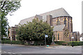
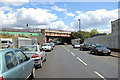
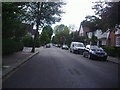
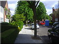
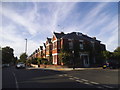

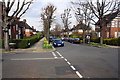
57 photos from this area
Area Information
Key information about the W5 1AQ including its size, population, and administrative classification.
- Area Type
- Postcode
- Area Size
- 1.4 hectares
- Population
- 1492
- Population Density
- 5902 people/km²
House Prices in W5 1AQ
34
Properties
£574,925
Average Sold Price
£105,500
Lowest Price
£1,097,000
Highest Price
Showing 34 properties
| Address | Type | Beds | Baths | Last Sale Price | Last Sale Date | |
|---|---|---|---|---|---|---|
| 97 Brunswick Road, Ealing, W5 1AQ | house | 5 | 2 | £845,000 | Mar 2025 | |
| 93 Brunswick Road, Ealing, W5 1AQ | house | 3 | 1 | £880,000 | Sep 2022 | |
| 103 Brunswick Road, Ealing, W5 1AQ | Semi-detached | 5 | 1 | £1,097,000 | Jun 2021 | |
| 83 Brunswick Road, Ealing, W5 1AQ | Flat | - | 1 | £910,000 | Nov 2020 | |
| 105 Brunswick Road, Ealing, W5 1AQ | Detached | 1 | 1 | £885,000 | Jan 2020 | |
| 91 Brunswick Road, Ealing, W5 1AQ | house | 5 | 1 | £970,000 | Nov 2017 | |
| 115 Brunswick Road, Ealing, W5 1AQ | house | - | - | £675,000 | Aug 2014 | |
| 107 Brunswick Road, Ealing, W5 1AQ | Semi-detached | 4 | 2 | £610,050 | Sep 2013 | |
| 111 Brunswick Road, Ealing, W5 1AQ | house | - | - | £510,000 | Jan 2013 | |
| 85 Brunswick Road, Ealing, W5 1AQ | house | 4 | 3 | £590,000 | Dec 2012 |
Page 1 of 4
Energy Efficiency in W5 1AQ
Amenities
Schools
| Rank | School | Type | Entry gender | Ages |
|---|
Explore more schools in this area
Go to Schools tabDemographics
Household Size
Family (3-5 people)
most common
Accommodation Type
Houses
most common
Tenure
84
majority
Ethnic Group
White
most common
Religion
N/A
most common
Household Composition
N/A
most common
Age
47
median
Adults (30-64 years)
most common
Household Deprivation
N/A
with no deprivation
NS-SEC
60
in Lower managerial occupations
Explore more demographic insights in this area
Go to Demographics tabPlanning
Planning Constraints
- Flood RiskPremium
- Ramsar Wetland SitesPremium
- Area of Outstanding Natural BeautyPremium
- Protected Nature ReservePremium
- Protected WoodlandPremium