Area Overview for W13 9XN
Photos of W13 9XN
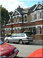
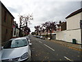
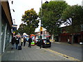


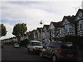
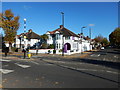
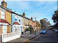
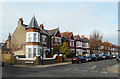
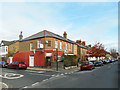
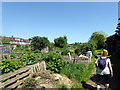
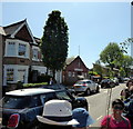
65 photos from this area
Area Information
Key information about the W13 9XN including its size, population, and administrative classification.
- Area Type
- Postcode
- Area Size
- 1.9 hectares
- Population
- 1755
- Population Density
- 7694 people/km²
House Prices in W13 9XN
46
Properties
£624,982
Average Sold Price
£118,000
Lowest Price
£1,140,000
Highest Price
Showing 46 properties
| Address | Type | Beds | Baths | Last Sale Price | Last Sale Date | |
|---|---|---|---|---|---|---|
| 27 Chalfont Way, West Ealing, W13 9XN | Terraced | 3 | 1 | £815,000 | Jul 2025 | |
| 11 Chalfont Way, West Ealing, W13 9XN | Terraced | 4 | 2 | £990,000 | Dec 2024 | |
| 23 Chalfont Way, West Ealing, W13 9XN | Terraced | 4 | 2 | £1,025,000 | Nov 2024 | |
| 15 Chalfont Way, West Ealing, W13 9XN | Semi-detached | 5 | 3 | £1,140,000 | Feb 2024 | |
| 44 Chalfont Way, West Ealing, W13 9XN | Semi-detached | 4 | 1 | £915,000 | Jul 2023 | |
| 16 Chalfont Way, West Ealing, W13 9XN | house | - | - | £832,500 | Sep 2021 | |
| 52 Chalfont Way, West Ealing, W13 9XN | house | - | - | £927,500 | Mar 2021 | |
| 20 Chalfont Way, West Ealing, W13 9XN | house | 4 | 2 | £775,000 | Nov 2020 | |
| 30 Chalfont Way, West Ealing, W13 9XN | Terraced | 3 | 1 | £740,000 | Jul 2019 | |
| 6 Chalfont Way, West Ealing, W13 9XN | house | 3 | 1 | £792,000 | Apr 2019 |
Page 1 of 5
Energy Efficiency in W13 9XN
Amenities
Schools
| Rank | School | Type | Entry gender | Ages |
|---|
Explore more schools in this area
Go to Schools tabDemographics
Household Size
Family (3-5 people)
most common
Accommodation Type
Houses
most common
Tenure
76
majority
Ethnic Group
White
most common
Religion
N/A
most common
Household Composition
N/A
most common
Age
47
median
Adults (30-64 years)
most common
Household Deprivation
N/A
with no deprivation
NS-SEC
50
in Lower managerial occupations
Explore more demographic insights in this area
Go to Demographics tabPlanning
Planning Constraints
- Flood RiskPremium
- Ramsar Wetland SitesPremium
- Area of Outstanding Natural BeautyPremium
- Protected Nature ReservePremium
- Protected WoodlandPremium