Area Overview for W13 9UL
Photos of W13 9UL
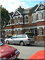
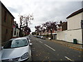
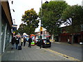
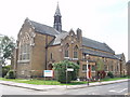

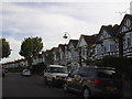
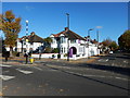
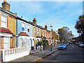
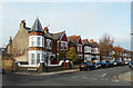
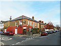
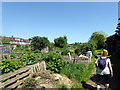
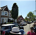
65 photos from this area
Area Information
Key information about the W13 9UL including its size, population, and administrative classification.
- Area Type
- Postcode
- Area Size
- 6736 m²
- Population
- 1755
- Population Density
- 7694 people/km²
House Prices in W13 9UL
22
Properties
£793,594
Average Sold Price
£435,000
Lowest Price
£995,000
Highest Price
Showing 22 properties
| Address | Type | Beds | Baths | Last Sale Price | Last Sale Date | |
|---|---|---|---|---|---|---|
| 60 Haslemere Avenue, West Ealing, W13 9UL | Terraced | 5 | 1 | £912,500 | Jun 2025 | |
| 72 Haslemere Avenue, West Ealing, W13 9UL | house | - | - | £907,500 | Nov 2021 | |
| 74 Haslemere Avenue, West Ealing, W13 9UL | Terraced | 5 | 2 | £995,000 | Jan 2021 | |
| 54 Haslemere Avenue, West Ealing, W13 9UL | Terraced | 1 | 1 | £710,000 | Nov 2018 | |
| 50 Haslemere Avenue, West Ealing, W13 9UL | house | - | - | £843,750 | Aug 2017 | |
| 52 Haslemere Avenue, West Ealing, W13 9UL | house | 4 | 1 | £790,000 | Mar 2016 | |
| 64 Haslemere Avenue, West Ealing, W13 9UL | Terraced | 3 | 1 | £755,000 | Jan 2016 | |
| 58 Haslemere Avenue, West Ealing, W13 9UL | Terraced | - | - | £435,000 | Mar 2006 | |
| 80A Haslemere Avenue, West Ealing, W13 9UL | Maisonette | 2 | 2 | - | - | |
| 66 Haslemere Avenue, West Ealing, W13 9UL | Terraced | 3 | 1 | - | - |
Page 1 of 3
Energy Efficiency in W13 9UL
Amenities
Schools
| Rank | School | Type | Entry gender | Ages |
|---|
Explore more schools in this area
Go to Schools tabDemographics
Household Size
Family (3-5 people)
most common
Accommodation Type
Houses
most common
Tenure
76
majority
Ethnic Group
White
most common
Religion
N/A
most common
Household Composition
N/A
most common
Age
47
median
Adults (30-64 years)
most common
Household Deprivation
N/A
with no deprivation
NS-SEC
50
in Lower managerial occupations
Explore more demographic insights in this area
Go to Demographics tabPlanning
Planning Constraints
- Flood RiskPremium
- Ramsar Wetland SitesPremium
- Area of Outstanding Natural BeautyPremium
- Protected Nature ReservePremium
- Protected WoodlandPremium