Area Overview for W13 9XQ
Photos of W13 9XQ
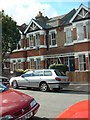
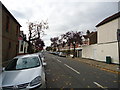
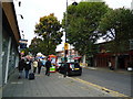
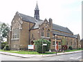

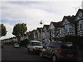
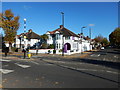
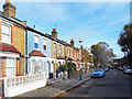
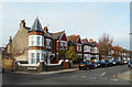
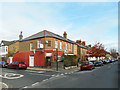
65 photos from this area
Area Information
Key information about the W13 9XQ including its size, population, and administrative classification.
- Area Type
- Postcode
- Area Size
- 5811 m²
- Population
- 1755
- Population Density
- 7694 people/km²
House Prices in W13 9XQ
22
Properties
£568,708
Average Sold Price
£167,500
Lowest Price
£945,000
Highest Price
Showing 22 properties
| Address | Type | Beds | Baths | Last Sale Price | Last Sale Date | |
|---|---|---|---|---|---|---|
| 22 Fulmer Way, West Ealing, W13 9XQ | Terraced | 3 | 1 | £825,000 | Mar 2025 | |
| 18 Fulmer Way, West Ealing, W13 9XQ | Terraced | 4 | 2 | £945,000 | May 2023 | |
| 9 Fulmer Way, West Ealing, W13 9XQ | house | - | - | £780,000 | May 2021 | |
| 6 Fulmer Way, West Ealing, W13 9XQ | house | 3 | - | £915,000 | Jun 2017 | |
| 3 Fulmer Way, West Ealing, W13 9XQ | house | - | - | £772,500 | Oct 2015 | |
| 19 Fulmer Way, West Ealing, W13 9XQ | house | - | - | £647,000 | Aug 2013 | |
| 4 Fulmer Way, West Ealing, W13 9XQ | house | 3 | - | £480,000 | Jun 2010 | |
| 14 Fulmer Way, West Ealing, W13 9XQ | house | - | - | £425,000 | Nov 2009 | |
| 7 Fulmer Way, West Ealing, W13 9XQ | Terraced | - | - | £387,500 | Jan 2006 | |
| 24 Fulmer Way, West Ealing, W13 9XQ | house | - | - | £257,500 | Aug 2000 |
Page 1 of 3
Energy Efficiency in W13 9XQ
Amenities
Schools
| Rank | School | Type | Entry gender | Ages |
|---|
Explore more schools in this area
Go to Schools tabDemographics
Household Size
Family (3-5 people)
most common
Accommodation Type
Houses
most common
Tenure
76
majority
Ethnic Group
White
most common
Religion
N/A
most common
Household Composition
N/A
most common
Age
47
median
Adults (30-64 years)
most common
Household Deprivation
N/A
with no deprivation
NS-SEC
50
in Lower managerial occupations
Explore more demographic insights in this area
Go to Demographics tabPlanning
Planning Constraints
- Flood RiskPremium
- Ramsar Wetland SitesPremium
- Area of Outstanding Natural BeautyPremium
- Protected Nature ReservePremium
- Protected WoodlandPremium