Area Overview for W13 9NN
Photos of W13 9NN
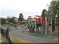
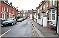

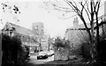
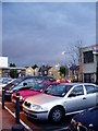
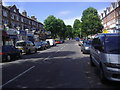
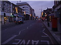
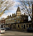
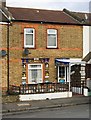


100 photos from this area
Area Information
Key information about the W13 9NN including its size, population, and administrative classification.
- Area Type
- Postcode
- Area Size
- 6807 m²
- Population
- 1445
- Population Density
- 8113 people/km²
House Prices in W13 9NN
36
Properties
£750,167
Average Sold Price
£112,000
Lowest Price
£1,630,000
Highest Price
Showing 36 properties
| Address | Type | Beds | Baths | Last Sale Price | Last Sale Date | |
|---|---|---|---|---|---|---|
| 15 Lavington Road, West Ealing, W13 9NN | Semi-detached | 4 | 2 | £1,400,000 | May 2023 | |
| 13 Lavington Road, West Ealing, W13 9NN | house | 4 | 2 | £1,630,000 | Oct 2022 | |
| 7 Lavington Road, West Ealing, W13 9NN | house | - | - | £1,165,000 | Sep 2021 | |
| 25 Lavington Road, West Ealing, W13 9NN | Semi-detached | 4 | 1 | £1,240,000 | Nov 2017 | |
| 1 Lavington Road, West Ealing, W13 9NN | Semi-detached | 1 | 1 | £240,000 | Jan 2004 | |
| 9 Lavington Road, West Ealing, W13 9NN | Semi-detached | 4 | 2 | £430,000 | Feb 2002 | |
| 29 Lavington Road, West Ealing, W13 9NN | Semi-detached | 4 | 2 | £399,500 | Aug 2000 | |
| 39A Lavington Road, West Ealing, W13 9NN | Flat | - | - | £135,000 | Sep 1998 | |
| 23 Lavington Road, West Ealing, W13 9NN | house | 6 | - | £112,000 | Jul 1997 | |
| Lavington House, Lavington Road, West Ealing, W13 9NN | Detached | 4 | - | - | - |
Page 1 of 4
Energy Efficiency in W13 9NN
Amenities
Schools
| Rank | School | Type | Entry gender | Ages |
|---|
Explore more schools in this area
Go to Schools tabDemographics
Household Size
One person
most common
Accommodation Type
Flats
most common
Tenure
31
majority
Ethnic Group
White
most common
Religion
N/A
most common
Household Composition
N/A
most common
Age
47
median
Adults (30-64 years)
most common
Household Deprivation
N/A
with no deprivation
NS-SEC
42
in Lower managerial occupations
Explore more demographic insights in this area
Go to Demographics tabPlanning
Planning Constraints
- Flood RiskPremium
- Ramsar Wetland SitesPremium
- Area of Outstanding Natural BeautyPremium
- Protected Nature ReservePremium
- Protected WoodlandPremium