Area Overview for W13 9JT
Photos of W13 9JT

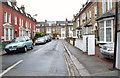

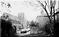
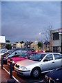
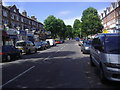

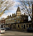
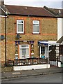


100 photos from this area
Area Information
Key information about the W13 9JT including its size, population, and administrative classification.
- Area Type
- Postcode
- Area Size
- 1.4 hectares
- Population
- 1445
- Population Density
- 8113 people/km²
House Prices in W13 9JT
52
Properties
£797,421
Average Sold Price
£69,000
Lowest Price
£1,575,000
Highest Price
Showing 52 properties
| Address | Type | Beds | Baths | Last Sale Price | Last Sale Date | |
|---|---|---|---|---|---|---|
| 39 Loveday Road, West Ealing, W13 9JT | Semi-detached | 5 | 3 | £1,323,100 | Nov 2023 | |
| 23 Loveday Road, West Ealing, W13 9JT | Semi-detached | 4 | 1 | £1,355,000 | Sep 2023 | |
| 25 Loveday Road, West Ealing, W13 9JT | Semi-detached | 5 | 2 | £1,575,000 | Jun 2022 | |
| 59 Loveday Road, West Ealing, W13 9JT | Retail | 4 | 2 | £1,118,000 | Mar 2022 | |
| 51A Loveday Road, West Ealing, W13 9JT | Flat | 2 | 1 | £495,000 | Mar 2022 | |
| 65 Loveday Road, West Ealing, W13 9JT | Semi-detached | 5 | 3 | £1,250,000 | Mar 2020 | |
| 53 Loveday Road, West Ealing, W13 9JT | house | - | - | £1,280,000 | Aug 2017 | |
| 63 Loveday Road, West Ealing, W13 9JT | Flat | 2 | 1 | £1,160,000 | Jun 2017 | |
| 9 Loveday Road, West Ealing, W13 9JT | Flat | 2 | 1 | £515,000 | May 2017 | |
| 41 Loveday Road, West Ealing, W13 9JT | house | - | - | £1,150,000 | Jan 2016 |
Page 1 of 6
Energy Efficiency in W13 9JT
Amenities
Schools
| Rank | School | Type | Entry gender | Ages |
|---|
Explore more schools in this area
Go to Schools tabDemographics
Household Size
One person
most common
Accommodation Type
Flats
most common
Tenure
31
majority
Ethnic Group
White
most common
Religion
N/A
most common
Household Composition
N/A
most common
Age
47
median
Adults (30-64 years)
most common
Household Deprivation
N/A
with no deprivation
NS-SEC
42
in Lower managerial occupations
Explore more demographic insights in this area
Go to Demographics tabPlanning
Planning Constraints
- Flood RiskPremium
- Ramsar Wetland SitesPremium
- Area of Outstanding Natural BeautyPremium
- Protected Nature ReservePremium
- Protected WoodlandPremium