Area Overview for W13 9LF
Photos of W13 9LF
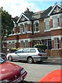
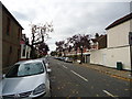
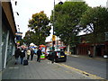
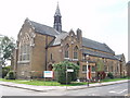

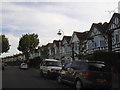
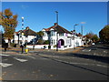
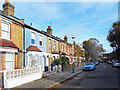
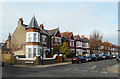
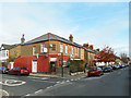
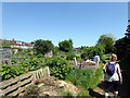
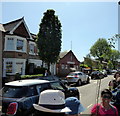
65 photos from this area
Area Information
Key information about the W13 9LF including its size, population, and administrative classification.
- Area Type
- Postcode
- Area Size
- 920 m²
- Population
- 1445
- Population Density
- 8113 people/km²
House Prices in W13 9LF
8
Properties
£224,000
Average Sold Price
£40,000
Lowest Price
£380,000
Highest Price
Showing 8 properties
| Address | Type | Beds | Baths | Last Sale Price | Last Sale Date | |
|---|---|---|---|---|---|---|
| 4, Model Cottages, Northfield Avenue, West Ealing, W13 9LF | Flat | 2 | 1 | £306,000 | Dec 2024 | |
| 7, Model Cottages, Northfield Avenue, West Ealing, W13 9LF | Flat | 1 | 1 | £380,000 | Feb 2022 | |
| 5, Model Cottages, Northfield Avenue, West Ealing, W13 9LF | Flat | - | - | £285,000 | Aug 2019 | |
| 3, Model Cottages, Northfield Avenue, West Ealing, W13 9LF | Flat | 1 | 1 | £315,000 | Mar 2016 | |
| 6, Model Cottages, Northfield Avenue, West Ealing, W13 9LF | Flat | 1 | 1 | £205,000 | Apr 2013 | |
| 8, Model Cottages, Northfield Avenue, West Ealing, W13 9LF | Flat | - | - | £171,000 | Aug 2006 | |
| 2, Model Cottages, Northfield Avenue, West Ealing, W13 9LF | Maisonette | 2 | 1 | £90,000 | Oct 2000 | |
| 1, Model Cottages, Northfield Avenue, West Ealing, W13 9LF | Flat | 2 | 1 | £40,000 | Feb 1996 |
Energy Efficiency in W13 9LF
Amenities
Schools
| Rank | School | Type | Entry gender | Ages |
|---|
Explore more schools in this area
Go to Schools tabDemographics
Household Size
One person
most common
Accommodation Type
Flats
most common
Tenure
31
majority
Ethnic Group
White
most common
Religion
N/A
most common
Household Composition
N/A
most common
Age
47
median
Adults (30-64 years)
most common
Household Deprivation
N/A
with no deprivation
NS-SEC
42
in Lower managerial occupations
Explore more demographic insights in this area
Go to Demographics tabPlanning
Planning Constraints
- Flood RiskPremium
- Ramsar Wetland SitesPremium
- Area of Outstanding Natural BeautyPremium
- Protected Nature ReservePremium
- Protected WoodlandPremium