Area Overview for W13 9LS
Photos of W13 9LS
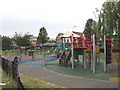
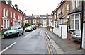

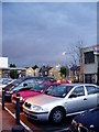
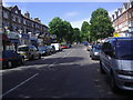
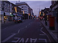
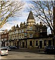
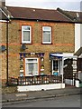
100 photos from this area
Area Information
Key information about the W13 9LS including its size, population, and administrative classification.
- Area Type
- Postcode
- Area Size
- 6633 m²
- Population
- 1481
- Population Density
- 7260 people/km²
House Prices in W13 9LS
26
Properties
£702,383
Average Sold Price
£245,000
Lowest Price
£1,250,000
Highest Price
Showing 26 properties
| Address | Type | Beds | Baths | Last Sale Price | Last Sale Date | |
|---|---|---|---|---|---|---|
| 58 Lavington Road, West Ealing, W13 9LS | Semi-detached | 5 | 3 | £1,100,000 | Feb 2020 | |
| 55 Lavington Road, West Ealing, W13 9LS | Terraced | 5 | - | £1,250,000 | Jul 2015 | |
| 45 Lavington Road, West Ealing, W13 9LS | house | - | - | £891,450 | Aug 2013 | |
| 44 Lavington Road, West Ealing, W13 9LS | Detached | 4 | 2 | £755,000 | Oct 2011 | |
| 49 Lavington Road, West Ealing, W13 9LS | Terraced | 4 | 1 | £630,000 | Sep 2009 | |
| 60 Lavington Road, West Ealing, W13 9LS | Semi-detached | - | - | £780,000 | Jun 2007 | |
| 48 Lavington Road, West Ealing, W13 9LS | Semi-detached | - | - | £340,000 | May 2000 | |
| 64 Lavington Road, West Ealing, W13 9LS | Semi-detached | - | - | £330,000 | Dec 1999 | |
| 66 Lavington Road, West Ealing, W13 9LS | Detached | 5 | 2 | £245,000 | Aug 1996 | |
| 62B Lavington Road, West Ealing, W13 9LS | Flat | - | - | - | - |
Page 1 of 3
Energy Efficiency in W13 9LS
Amenities
Schools
| Rank | School | Type | Entry gender | Ages |
|---|
Explore more schools in this area
Go to Schools tabDemographics
Household Size
Family (3-5 people)
most common
Accommodation Type
Houses
most common
Tenure
80
majority
Ethnic Group
White
most common
Religion
N/A
most common
Household Composition
N/A
most common
Age
47
median
Adults (30-64 years)
most common
Household Deprivation
N/A
with no deprivation
NS-SEC
58
in Lower managerial occupations
Explore more demographic insights in this area
Go to Demographics tabPlanning
Planning Constraints
- Flood RiskPremium
- Ramsar Wetland SitesPremium
- Area of Outstanding Natural BeautyPremium
- Protected Nature ReservePremium
- Protected WoodlandPremium