Area Overview for UB7 7UE
Photos of UB7 7UE
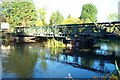
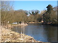
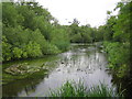
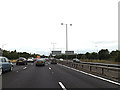
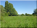
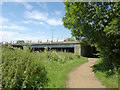
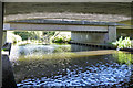
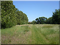
38 photos from this area
Area Information
Key information about the UB7 7UE including its size, population, and administrative classification.
- Area Type
- Postcode
- Area Size
- 1.2 hectares
- Population
- 1788
- Population Density
- 6664 people/km²
House Prices in UB7 7UE
35
Properties
£260,122
Average Sold Price
£163,000
Lowest Price
£403,000
Highest Price
Showing 35 properties
| Address | Type | Beds | Baths | Last Sale Price | Last Sale Date | |
|---|---|---|---|---|---|---|
| 57 Rowan Road, West Drayton, UB7 7UE | house | - | - | £389,000 | Jun 2022 | |
| 41 Rowan Road, West Drayton, UB7 7UE | Detached | 3 | 1 | £403,000 | Oct 2020 | |
| 114 Rowan Road, West Drayton, UB7 7UE | Flat | - | - | £182,000 | Jun 2019 | |
| 118 Rowan Road, West Drayton, UB7 7UE | Maisonette | 3 | 2 | £310,000 | Aug 2018 | |
| 43 Rowan Road, West Drayton, UB7 7UE | Semi-detached | 1 | 1 | £370,000 | Nov 2016 | |
| 104 Rowan Road, West Drayton, UB7 7UE | Maisonette | 3 | - | £280,000 | Jan 2016 | |
| 110 Rowan Road, West Drayton, UB7 7UE | house | - | - | £240,000 | Aug 2015 | |
| 138 Rowan Road, West Drayton, UB7 7UE | Semi-detached | 3 | 1 | £316,000 | Jan 2015 | |
| 130 Rowan Road, West Drayton, UB7 7UE | Detached | 2 | 1 | £283,000 | Aug 2014 | |
| 59 Rowan Road, West Drayton, UB7 7UE | house | 3 | - | £230,000 | Jan 2012 |
Page 1 of 4
Energy Efficiency in UB7 7UE
Amenities
Schools
| Rank | School | Type | Entry gender | Ages |
|---|
Explore more schools in this area
Go to Schools tabDemographics
Household Size
Family (3-5 people)
most common
Accommodation Type
Houses
most common
Tenure
39
majority
Ethnic Group
White
most common
Religion
N/A
most common
Household Composition
N/A
most common
Age
47
median
Adults (30-64 years)
most common
Household Deprivation
N/A
with no deprivation
NS-SEC
19
in Lower managerial occupations
Explore more demographic insights in this area
Go to Demographics tabPlanning
Planning Constraints
- Flood RiskPremium
- Ramsar Wetland SitesPremium
- Area of Outstanding Natural BeautyPremium
- Protected Nature ReservePremium
- Protected WoodlandPremium