Area Overview for UB7 7UD
Photos of UB7 7UD
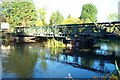
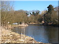
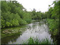
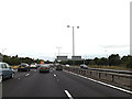
38 photos from this area
Area Information
Key information about the UB7 7UD including its size, population, and administrative classification.
- Area Type
- Postcode
- Area Size
- 6722 m²
- Population
- 1788
- Population Density
- 6664 people/km²
House Prices in UB7 7UD
24
Properties
£192,808
Average Sold Price
£63,000
Lowest Price
£400,000
Highest Price
Showing 24 properties
| Address | Type | Beds | Baths | Last Sale Price | Last Sale Date | |
|---|---|---|---|---|---|---|
| 92 Rowan Road, West Drayton, UB7 7UD | Maisonette | - | - | £290,000 | Jul 2023 | |
| 62 Rowan Road, West Drayton, UB7 7UD | Maisonette | 3 | 1 | £270,000 | Mar 2023 | |
| 29 Rowan Road, West Drayton, UB7 7UD | house | - | - | £387,000 | Dec 2020 | |
| 37 Rowan Road, West Drayton, UB7 7UD | Semi-detached | 3 | 1 | £400,000 | Oct 2019 | |
| 76 Rowan Road, West Drayton, UB7 7UD | Terraced | 3 | 2 | £124,000 | May 2011 | |
| 88 Rowan Road, West Drayton, UB7 7UD | house | - | - | £149,500 | Dec 2009 | |
| 70 Rowan Road, West Drayton, UB7 7UD | Flat | - | - | £178,000 | Aug 2008 | |
| 39 Rowan Road, West Drayton, UB7 7UD | Semi-detached | 3 | 1 | £180,000 | Dec 2004 | |
| 68 Rowan Road, West Drayton, UB7 7UD | Maisonette | 3 | 1 | £160,000 | Jun 2004 | |
| 84 Rowan Road, West Drayton, UB7 7UD | Flat | - | - | £75,000 | Apr 2003 |
Page 1 of 3
Energy Efficiency in UB7 7UD
Amenities
Schools
| Rank | School | Type | Entry gender | Ages |
|---|
Explore more schools in this area
Go to Schools tabDemographics
Household Size
Family (3-5 people)
most common
Accommodation Type
Houses
most common
Tenure
39
majority
Ethnic Group
White
most common
Religion
N/A
most common
Household Composition
N/A
most common
Age
47
median
Adults (30-64 years)
most common
Household Deprivation
N/A
with no deprivation
NS-SEC
19
in Lower managerial occupations
Explore more demographic insights in this area
Go to Demographics tabPlanning
Planning Constraints
- Flood RiskPremium
- Ramsar Wetland SitesPremium
- Area of Outstanding Natural BeautyPremium
- Protected Nature ReservePremium
- Protected WoodlandPremium