Area Overview for UB10 9NB
Photos of UB10 9NB
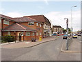
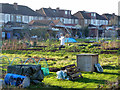
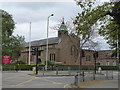
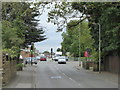
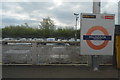
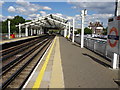
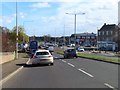
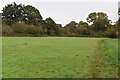
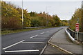
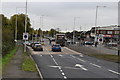
28 photos from this area
Area Information
Key information about the UB10 9NB including its size, population, and administrative classification.
- Area Type
- Postcode
- Area Size
- 5.0 hectares
- Population
- 1438
- Population Density
- 2536 people/km²
House Prices in UB10 9NB
16
Properties
£447,682
Average Sold Price
£151,500
Lowest Price
£670,000
Highest Price
Showing 16 properties
| Address | Type | Beds | Baths | Last Sale Price | Last Sale Date | |
|---|---|---|---|---|---|---|
| 64 Hercies Road, Uxbridge, UB10 9NB | Semi-detached | 3 | 1 | £610,000 | Sep 2025 | |
| 66 Hercies Road, Uxbridge, UB10 9NB | Semi-detached | 5 | 2 | £590,000 | Aug 2025 | |
| 74 Hercies Road, Uxbridge, UB10 9NB | Bungalow | 3 | 1 | £670,000 | Aug 2020 | |
| 52 Hercies Road, Uxbridge, UB10 9NB | Semi-detached | 3 | - | £512,500 | Dec 2016 | |
| 80 Hercies Road, Uxbridge, UB10 9NB | Detached | 4 | 2 | £525,000 | Sep 2013 | |
| 82 Hercies Road, Uxbridge, UB10 9NB | Semi-detached | - | - | £435,000 | Jan 2008 | |
| 76 Hercies Road, Uxbridge, UB10 9NB | Detached | - | - | £435,000 | Nov 2007 | |
| 54 Hercies Road, Uxbridge, UB10 9NB | Detached | 4 | 2 | £408,000 | Oct 2006 | |
| 78 Hercies Road, Uxbridge, UB10 9NB | Detached | - | - | £382,500 | Aug 2002 | |
| 60 Hercies Road, Uxbridge, UB10 9NB | Detached | - | - | £205,000 | Nov 1998 |
Page 1 of 2
Energy Efficiency in UB10 9NB
Amenities
Schools
| Rank | School | Type | Entry gender | Ages |
|---|
Explore more schools in this area
Go to Schools tabDemographics
Household Size
Family (3-5 people)
most common
Accommodation Type
Houses
most common
Tenure
74
majority
Ethnic Group
White
most common
Religion
N/A
most common
Household Composition
N/A
most common
Age
47
median
Adults (30-64 years)
most common
Household Deprivation
N/A
with no deprivation
NS-SEC
43
in Lower managerial occupations
Explore more demographic insights in this area
Go to Demographics tabPlanning
Planning Constraints
- Flood RiskPremium
- Ramsar Wetland SitesPremium
- Area of Outstanding Natural BeautyPremium
- Protected Nature ReservePremium
- Protected WoodlandPremium