Area Overview for UB10 9LU
Photos of UB10 9LU
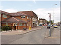
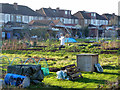
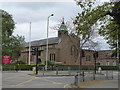
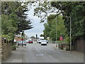
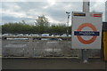
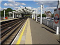
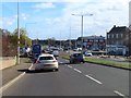
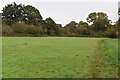
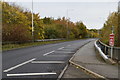
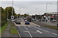
28 photos from this area
Area Information
Key information about the UB10 9LU including its size, population, and administrative classification.
- Area Type
- Postcode
- Area Size
- 2.8 hectares
- Population
- 1438
- Population Density
- 2536 people/km²
House Prices in UB10 9LU
48
Properties
£532,383
Average Sold Price
£123,000
Lowest Price
£915,000
Highest Price
Showing 48 properties
| Address | Type | Beds | Baths | Last Sale Price | Last Sale Date | |
|---|---|---|---|---|---|---|
| 135A Hercies Road, Uxbridge, UB10 9LU | Detached | 4 | 2 | £725,000 | Aug 2025 | |
| 103 Hercies Road, Uxbridge, UB10 9LU | Bungalow | 3 | 2 | £700,000 | Jul 2024 | |
| 111 Hercies Road, Uxbridge, UB10 9LU | Semi-detached | 3 | 3 | £830,000 | Mar 2024 | |
| 87 Hercies Road, Uxbridge, UB10 9LU | Detached | 4 | 2 | £820,000 | Jun 2023 | |
| 83 Hercies Road, Uxbridge, UB10 9LU | Bungalow | 3 | 2 | £915,000 | Mar 2023 | |
| 81 Hercies Road, Uxbridge, UB10 9LU | Retail | 4 | 2 | £805,000 | Mar 2022 | |
| 85 Hercies Road, Uxbridge, UB10 9LU | Bungalow | 3 | 2 | £670,000 | Nov 2020 | |
| 73 Hercies Road, Uxbridge, UB10 9LU | Detached | 4 | 3 | £855,000 | Jul 2019 | |
| 61 Hercies Road, Uxbridge, UB10 9LU | Bungalow | 4 | 3 | £600,000 | Apr 2019 | |
| 125 Hercies Road, Uxbridge, UB10 9LU | Semi-detached | 5 | 3 | £865,000 | Mar 2019 |
Page 1 of 5
Energy Efficiency in UB10 9LU
Amenities
Schools
| Rank | School | Type | Entry gender | Ages |
|---|
Explore more schools in this area
Go to Schools tabDemographics
Household Size
Family (3-5 people)
most common
Accommodation Type
Houses
most common
Tenure
74
majority
Ethnic Group
White
most common
Religion
N/A
most common
Household Composition
N/A
most common
Age
47
median
Adults (30-64 years)
most common
Household Deprivation
N/A
with no deprivation
NS-SEC
43
in Lower managerial occupations
Explore more demographic insights in this area
Go to Demographics tabPlanning
Planning Constraints
- Flood RiskPremium
- Ramsar Wetland SitesPremium
- Area of Outstanding Natural BeautyPremium
- Protected Nature ReservePremium
- Protected WoodlandPremium