Area Overview for UB10 9NA
Photos of UB10 9NA
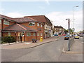
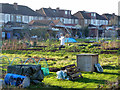
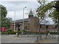
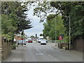
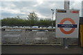
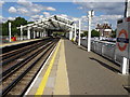
28 photos from this area
Area Information
Key information about the UB10 9NA including its size, population, and administrative classification.
- Area Type
- Postcode
- Area Size
- 4.1 hectares
- Population
- 1438
- Population Density
- 2536 people/km²
House Prices in UB10 9NA
53
Properties
£321,318
Average Sold Price
£105,000
Lowest Price
£670,000
Highest Price
Showing 53 properties
| Address | Type | Beds | Baths | Last Sale Price | Last Sale Date | |
|---|---|---|---|---|---|---|
| 10A Hercies Road, Uxbridge, UB10 9NA | Flat | - | - | £295,000 | Dec 2024 | |
| 46 Hercies Road, Uxbridge, UB10 9NA | Semi-detached | 4 | - | £635,000 | Jun 2021 | |
| 36 Hercies Road, Uxbridge, UB10 9NA | Semi-detached | 2 | - | £670,000 | Jun 2021 | |
| 6A Hercies Road, Uxbridge, UB10 9NA | Flat | - | - | £259,000 | Mar 2015 | |
| 30 Hercies Road, Uxbridge, UB10 9NA | Semi-detached | - | - | £290,000 | Apr 2009 | |
| 12A Hercies Road, Uxbridge, UB10 9NA | Maisonette | - | - | £275,000 | Nov 2006 | |
| 50 Hercies Road, Uxbridge, UB10 9NA | Semi-detached | - | - | £310,000 | Nov 2003 | |
| 28 Hercies Road, Uxbridge, UB10 9NA | Semi-detached | 4 | 2 | £323,000 | May 2003 | |
| 14A Hercies Road, Uxbridge, UB10 9NA | Flat | - | - | £105,000 | Mar 2002 | |
| 38 Hercies Road, Uxbridge, UB10 9NA | Semi-detached | 3 | 1 | £235,000 | May 2000 |
Page 1 of 6
Energy Efficiency in UB10 9NA
Amenities
Schools
| Rank | School | Type | Entry gender | Ages |
|---|
Explore more schools in this area
Go to Schools tabDemographics
Household Size
Family (3-5 people)
most common
Accommodation Type
Houses
most common
Tenure
74
majority
Ethnic Group
White
most common
Religion
N/A
most common
Household Composition
N/A
most common
Age
47
median
Adults (30-64 years)
most common
Household Deprivation
N/A
with no deprivation
NS-SEC
43
in Lower managerial occupations
Explore more demographic insights in this area
Go to Demographics tabPlanning
Planning Constraints
- Flood RiskPremium
- Ramsar Wetland SitesPremium
- Area of Outstanding Natural BeautyPremium
- Protected Nature ReservePremium
- Protected WoodlandPremium