Area Overview for UB10 9JU
Photos of UB10 9JU
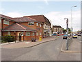
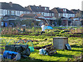
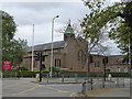
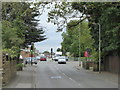
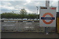
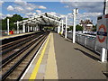
28 photos from this area
Area Information
Key information about the UB10 9JU including its size, population, and administrative classification.
- Area Type
- Postcode
- Area Size
- 6647 m²
- Population
- 1538
- Population Density
- 4501 people/km²
House Prices in UB10 9JU
25
Properties
£1,910,000
Average Sold Price
£1,910,000
Lowest Price
£1,910,000
Highest Price
Showing 25 properties
| Address | Type | Beds | Baths | Last Sale Price | Last Sale Date | |
|---|---|---|---|---|---|---|
| 329 Long Lane, Hillingdon, Uxbridge, UB10 9JU | Flat | - | - | £1,910,000 | Feb 2020 | |
| 333A Long Lane, Hillingdon, Uxbridge, UB10 9JU | Flat | - | - | - | - | |
| 337A Long Lane, Hillingdon, Uxbridge, UB10 9JU | Flat | - | - | - | - | |
| 319A Long Lane, Hillingdon, Uxbridge, UB10 9JU | Flat | 1 | 1 | - | - | |
| 321A Long Lane, Hillingdon, Uxbridge, UB10 9JU | Flat | - | - | - | - | |
| 317A Long Lane, Hillingdon, Uxbridge, UB10 9JU | Terraced | 3 | 1 | - | - | |
| 331 Long Lane, Hillingdon, Uxbridge, UB10 9JU | office_workshop | - | - | - | - | |
| 327 Long Lane, Hillingdon, Uxbridge, UB10 9JU | Retail | - | - | - | - | |
| 325 Long Lane, Hillingdon, Uxbridge, UB10 9JU | Retail | - | - | - | - | |
| 335A Long Lane, Hillingdon, Uxbridge, UB10 9JU | Flat | - | - | - | - |
Page 1 of 3
Energy Efficiency in UB10 9JU
Amenities
Schools
| Rank | School | Type | Entry gender | Ages |
|---|
Explore more schools in this area
Go to Schools tabDemographics
Household Size
Family (3-5 people)
most common
Accommodation Type
Houses
most common
Tenure
76
majority
Ethnic Group
White
most common
Religion
N/A
most common
Household Composition
N/A
most common
Age
47
median
Adults (30-64 years)
most common
Household Deprivation
N/A
with no deprivation
NS-SEC
35
in Lower managerial occupations
Explore more demographic insights in this area
Go to Demographics tabPlanning
Planning Constraints
- Flood RiskPremium
- Ramsar Wetland SitesPremium
- Area of Outstanding Natural BeautyPremium
- Protected Nature ReservePremium
- Protected WoodlandPremium