Area Overview for UB10 9BZ
Photos of UB10 9BZ
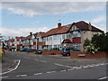
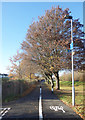
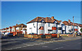
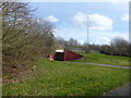
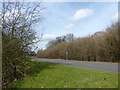
34 photos from this area
Area Information
Key information about the UB10 9BZ including its size, population, and administrative classification.
- Area Type
- Postcode
- Area Size
- 1.5 hectares
- Population
- 1500
- Population Density
- 6977 people/km²
House Prices in UB10 9BZ
44
Properties
£313,489
Average Sold Price
£68,200
Lowest Price
£545,000
Highest Price
Showing 44 properties
| Address | Type | Beds | Baths | Last Sale Price | Last Sale Date | |
|---|---|---|---|---|---|---|
| 90 Ryefield Avenue, Uxbridge, UB10 9BZ | Terraced | 3 | 1 | £490,000 | Dec 2024 | |
| 121 Ryefield Avenue, Uxbridge, UB10 9BZ | Terraced | 3 | 1 | £475,000 | Feb 2024 | |
| 119 Ryefield Avenue, Uxbridge, UB10 9BZ | Terraced | 3 | 1 | £506,000 | Jun 2023 | |
| 80 Ryefield Avenue, Uxbridge, UB10 9BZ | Terraced | 3 | 2 | £435,000 | May 2022 | |
| 125 Ryefield Avenue, Uxbridge, UB10 9BZ | Terraced | 3 | 1 | £430,000 | Apr 2021 | |
| 117 Ryefield Avenue, Uxbridge, UB10 9BZ | Terraced | 3 | 1 | £475,000 | Jan 2021 | |
| 100 Ryefield Avenue, Uxbridge, UB10 9BZ | Terraced | 3 | 1 | £425,000 | Jul 2020 | |
| 105 Ryefield Avenue, Uxbridge, UB10 9BZ | Terraced | 3 | 1 | £390,000 | Jan 2020 | |
| 129 Ryefield Avenue, Uxbridge, UB10 9BZ | Terraced | 4 | 2 | £545,000 | Nov 2018 | |
| 88 Ryefield Avenue, Uxbridge, UB10 9BZ | house | 3 | 1 | £470,000 | Aug 2017 |
Page 1 of 5
Energy Efficiency in UB10 9BZ
Amenities
Schools
| Rank | School | Type | Entry gender | Ages |
|---|
Explore more schools in this area
Go to Schools tabDemographics
Household Size
Family (3-5 people)
most common
Accommodation Type
Houses
most common
Tenure
81
majority
Ethnic Group
White
most common
Religion
N/A
most common
Household Composition
N/A
most common
Age
47
median
Adults (30-64 years)
most common
Household Deprivation
N/A
with no deprivation
NS-SEC
35
in Lower managerial occupations
Explore more demographic insights in this area
Go to Demographics tabPlanning
Planning Constraints
- Flood RiskPremium
- Ramsar Wetland SitesPremium
- Area of Outstanding Natural BeautyPremium
- Protected Nature ReservePremium
- Protected WoodlandPremium